File:Direct route through the Northwest Passage.jpg
Jump to navigation
Jump to search

Size of this preview: 800 × 528 pixels. Other resolutions: 320 × 211 pixels | 640 × 422 pixels | 1,024 × 675 pixels | 1,280 × 844 pixels | 2,017 × 1,330 pixels.
Original file (2,017 × 1,330 pixels, file size: 1.34 MB, MIME type: image/jpeg)
Captions
Captions
Add a one-line explanation of what this file represents
Summary[edit]
| Direct route through the Northwest Passage | |
|---|---|
| Photographer |
Envisat satellite |
| Title |
Direct route through the Northwest Passage |
| Description |
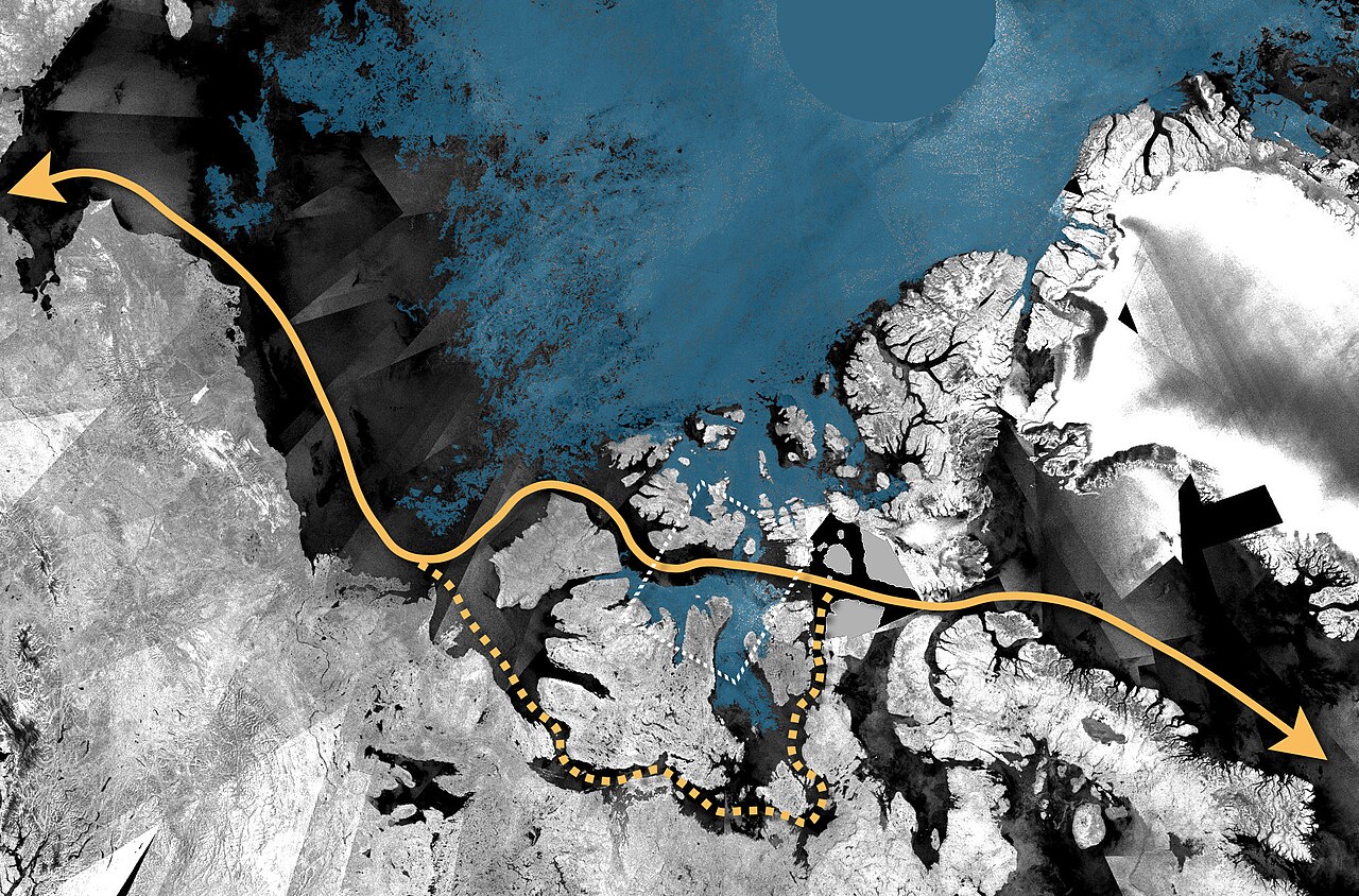
English: Envisat ASAR mosaic from mid-August 2008 showing an almost ice-free Northwest Passage. The direct route through the Northwest Passage is highlighted in the picture by an orange line. The orange dotted line shows the indirect route, called the Amundsen Northwest Passage, which has been passable for almost a month. |
| Depicted place | Northwest Passage |
| Date | mid August 2008 |
| Collection | European Space Agency |
| Accession number |
221252 |
| Credit line | ESA |
| Source | http://www.esa.int/spaceinimages/Images/2008/08/Direct_route_through_the_Northwest_Passage |
Licensing[edit]
This file is licensed under the Creative Commons Attribution-ShareAlike 3.0 IGO license.
- You are free:
- to share – to copy, distribute and transmit the work
- to remix – to adapt the work
- Under the following conditions:
- attribution – You must give appropriate credit, provide a link to the license, and indicate if changes were made. You may do so in any reasonable manner, but not in any way that suggests the licensor endorses you or your use.
- share alike – If you remix, transform, or build upon the material, you must distribute your contributions under the same or compatible license as the original.
File history
Click on a date/time to view the file as it appeared at that time.
| Date/Time | Thumbnail | Dimensions | User | Comment | |
|---|---|---|---|---|---|
| current | 08:29, 2 March 2017 | | 2,017 × 1,330 (1.34 MB) | Revent (talk | contribs) | =={{int:filedesc}}== {{Photograph |photographer = Envisat satellite |title = Direct route through the Northwest Passage |description = {{en|1=Envisat ASAR mosaic from mid-August 2008 showing an almost ice-free Northwest Pas... |
You cannot overwrite this file.
File usage on Commons
The following 4 pages use this file:
File usage on other wikis
The following other wikis use this file:
- Usage on it.wikipedia.org
- Usage on pt.wikipedia.org
- Usage on vec.wikipedia.org