File:Desierto de Atacama en la Carta esférica de las costas del Reyno de Chile (1799).jpg
Jump to navigation
Jump to search
Size of this preview: 303 × 599 pixels. Other resolutions: 121 × 240 pixels | 243 × 480 pixels | 388 × 768 pixels | 1,172 × 2,316 pixels.
Original file (1,172 × 2,316 pixels, file size: 1.67 MB, MIME type: image/jpeg)
Captions
Captions
Add a one-line explanation of what this file represents
Summary[edit]
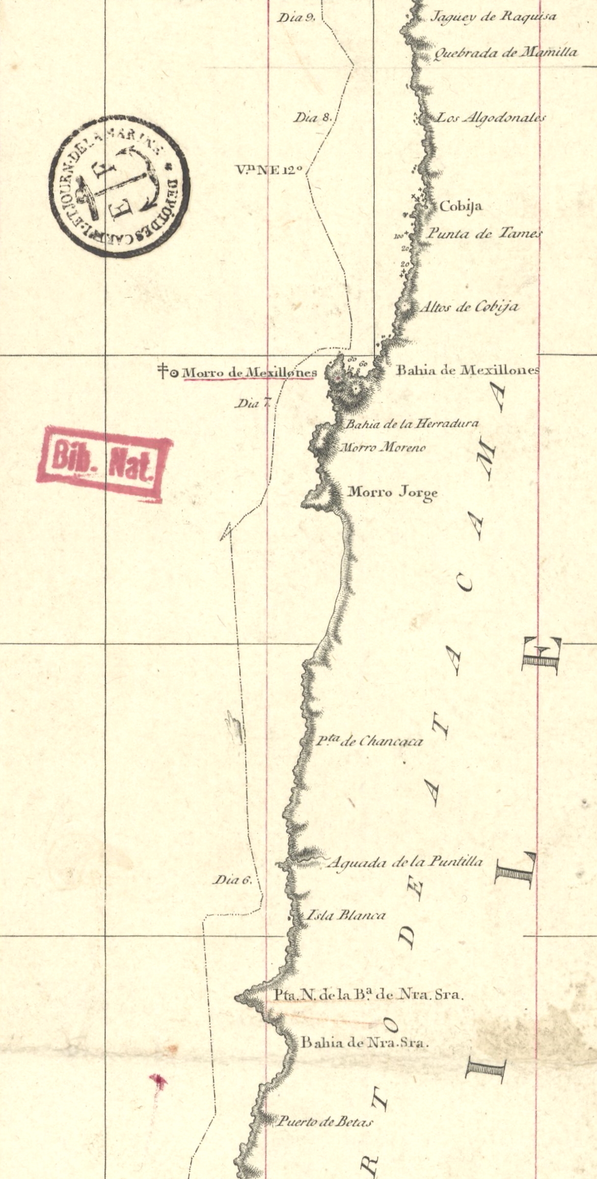
| Description |
Español: Carta esférica de las costas del Reyno de Chile (1799) Levantada de Orden del Rey en el año de 1790 por varios Oficiales de su Real Armada, presentada a S.M. por mano del Exmo. Señor D. Juan de Langara Secretario de Estado y del Despacho Universal de Marina ; Juan Moreno Tejada la grabó ; F. Bauzá la delineó ; P.M. Gangoiti la escribio. |
| Date | 1792-1799 |
| Source | https://gallica.bnf.fr/ark:/12148/btv1b53123317t |
| Author | Alejandro Malaspina; Juan Moreno Tejada; Juan de Lángara; Felipe Bauzá; Pedro Manuel Gangoiti |
| Other versions |
.jpg)
.jpg&action=edit§ion=1)
Licensing[edit]
.jpg&action=edit§ion=2)
This file has fallen into the public domain according to Chilean copyright law (No. 17336 and its amendments). Nevertheless, its author and source must be acknowledged.
See here for the type of material that is in the public domain (patrimonio cultural común / common cultural heritage).
|

|
File history
Click on a date/time to view the file as it appeared at that time.
| Date/Time | Thumbnail | Dimensions | User | Comment | |
|---|---|---|---|---|---|
| current | 17:02, 8 July 2022 | | 1,172 × 2,316 (1.67 MB) | Janitoalevic (talk | contribs) | File:Carta esférica de las costas del Reyno de Chile (1799).jpg cropped 83 % horizontally, 77 % vertically using CropTool with precise mode. |
You cannot overwrite this file.
File usage on Commons
The following 3 pages use this file:
.svg)
.png)
File usage on other wikis
The following other wikis use this file:
.jpg&oldid=861485838)