File:DerGaussPunkt-Bremen.jpg
Jump to navigation
Jump to search

Size of this preview: 723 × 600 pixels. Other resolutions: 289 × 240 pixels | 579 × 480 pixels | 926 × 768 pixels | 1,235 × 1,024 pixels | 1,500 × 1,244 pixels.
Original file (1,500 × 1,244 pixels, file size: 1.21 MB, MIME type: image/jpeg)
Captions
Captions
Add a one-line explanation of what this file represents
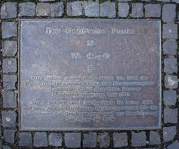
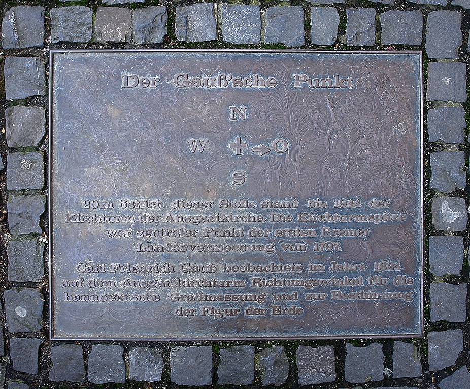
| Description | Gauß'scher Punkt in Bremen |
| Inscription | Caption:
Der Gauß'sche Punkt. 20 m östlich dieser Stelle stand bis 1944 der Carl Friedrich Gauß beobachtete im Jahre 1824 |
| Date | 12.03.2007 |
| Source | Self-photographed |
| Author | Jürgen Howaldt |
| Permission (Reusing this file) |
This file is licensed under the Creative Commons Attribution-Share Alike 2.0 Germany license.
 |
File history
Click on a date/time to view the file as it appeared at that time.
| Date/Time | Thumbnail | Dimensions | User | Comment | |
|---|---|---|---|---|---|
| current | 11:10, 14 March 2007 | | 1,500 × 1,244 (1.21 MB) | Godewind (talk | contribs) | {{Information| |Description=Der Gauß'scher Punkt in Bremen |Source=selbst erstelltes Foto |Date=12.03.2007 |Author=Jürgen Howaldt |Permission={{Bild-CC-by-sa/2.0/de}} |other_versions= }} {{de|Der Gauß'sche Punkt 20 m öst |
You cannot overwrite this file.
File usage on Commons
There are no pages that use this file.
File usage on other wikis
The following other wikis use this file:
- Usage on de.wikipedia.org
- Usage on en.wikipedia.org