File:Debeda River.JPG
Jump to navigation
Jump to search
Size of this preview: 800 × 600 pixels. Other resolutions: 320 × 240 pixels | 640 × 480 pixels | 1,024 × 768 pixels | 1,280 × 960 pixels | 2,560 × 1,920 pixels | 2,816 × 2,112 pixels.
Original file (2,816 × 2,112 pixels, file size: 2.7 MB, MIME type: image/jpeg)
Captions
Captions
Add a one-line explanation of what this file represents
Summary
[edit]
| Description |
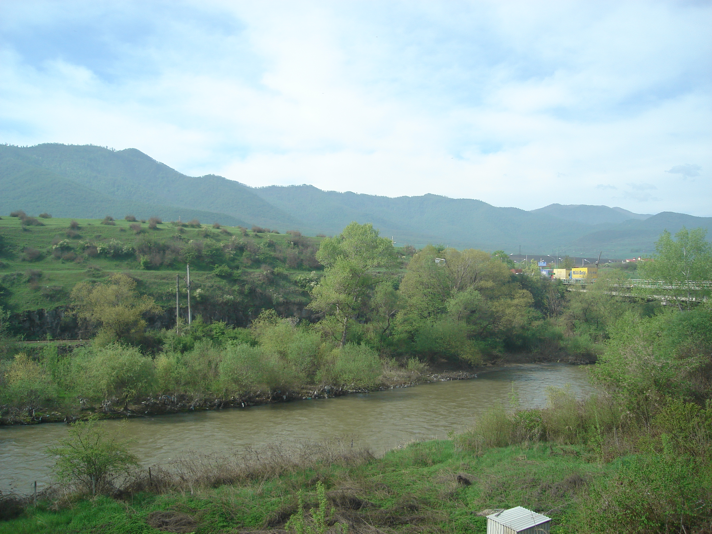
Azərbaycanca: Debeda River at the Armenia-Georgia border. The Georgian side of the border is seen on this photo taken from the Armenian side. The bridge to the right serves as a “neutral zone” between the two countries. Azərbaycanca: Ermənistan-Gürcüstan sərhəddində Tona çayı. Şəkil 2008-ci ilin aprel ayında çayın Ermənistan tərəfindəki sahilindən çəkilmişdir. Sağdakı körpü iki ölkə arasındakı keçid məntəqəsidir və Ləmbəli (erm.: e. Բագրատաշեն, l. Baqrataşen) kəndi ilə Sadaxlı dəmiryolu stansiyası arasında keçidi təmin edir. |
| Date | |
| Source | Own work |
| Author | Kober |
Licensing
[edit]
| I, the copyright holder of this work, release this work into the public domain. This applies worldwide. In some countries this may not be legally possible; if so: I grant anyone the right to use this work for any purpose, without any conditions, unless such conditions are required by law. |
File history
Click on a date/time to view the file as it appeared at that time.
| Date/Time | Thumbnail | Dimensions | User | Comment | |
|---|---|---|---|---|---|
| current | 15:39, 16 April 2008 | | 2,816 × 2,112 (2.7 MB) | Kober (talk | contribs) | {{Information |Description=Debeda River at the Armenia-Georgia border. The Georgian side of the border is seen on this photo taken from the Armenian side. The bridge to the right serves as a “neutral zone” between the two countries. |So |
You cannot overwrite this file.
File usage on Commons
The following page uses this file:
File usage on other wikis
The following other wikis use this file:
- Usage on arz.wikipedia.org
- Usage on az.wikipedia.org
- Usage on be.wikipedia.org
- Usage on ca.wikipedia.org
- Usage on ceb.wikipedia.org
- Usage on cv.wikipedia.org
- Usage on de.wikipedia.org
- Usage on fa.wikipedia.org
- Usage on hu.wikipedia.org
- Usage on hyw.wikipedia.org
- Usage on myv.wikipedia.org
- Usage on nl.wikipedia.org
- Usage on no.wikipedia.org
- Usage on ru.wikipedia.org
- Usage on sv.wikipedia.org
- Usage on www.wikidata.org
- Usage on zh.wikipedia.org