File:Dalejsky Potok a Kostel Sv Prokopa Prokopske Udoli.jpg
Jump to navigation
Jump to search

Size of this preview: 800 × 546 pixels. Other resolutions: 320 × 218 pixels | 640 × 437 pixels | 1,024 × 699 pixels | 1,280 × 873 pixels | 2,560 × 1,747 pixels | 4,488 × 3,062 pixels.
Original file (4,488 × 3,062 pixels, file size: 6.88 MB, MIME type: image/jpeg)
Captions
Captions
Add a one-line explanation of what this file represents
Summary[edit]
| Description |
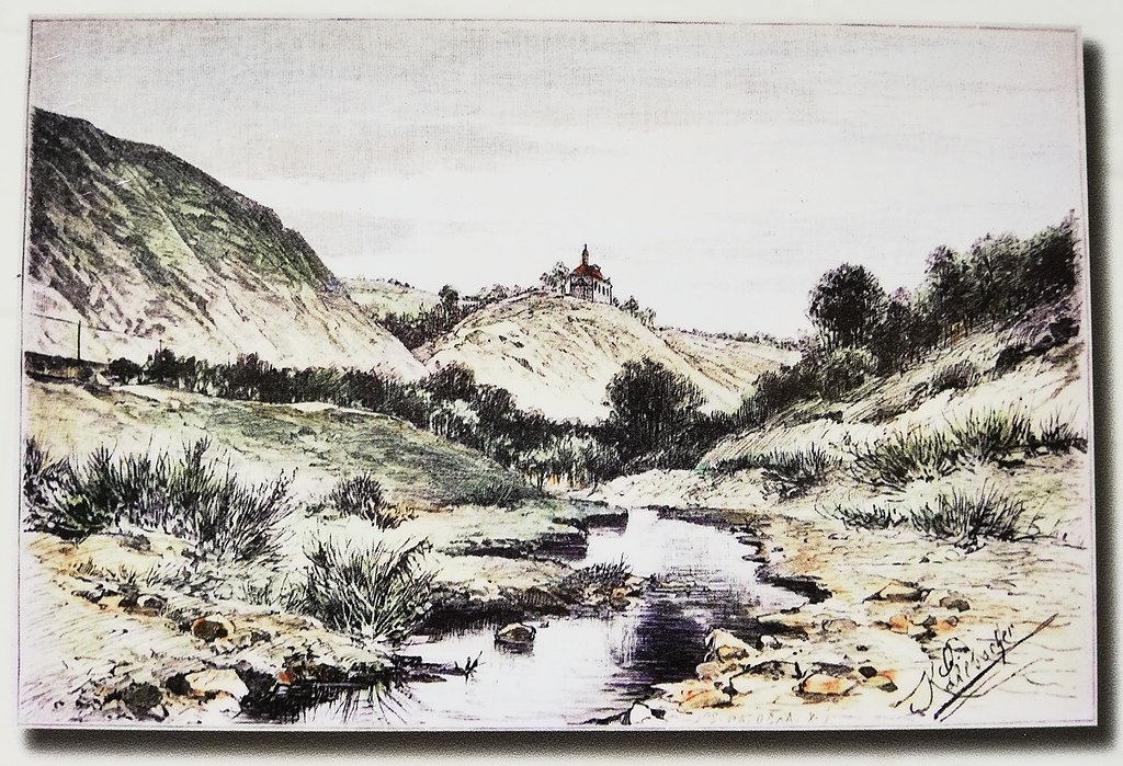
Čeština: Kostelík svatého Prokopa v pražském Prokopském údolí na romanticky koncipované (bez nároku na krajinnou přesnost) kresbě malíře Karla Liebschera (1851–1906). V popředí je Dalejský potok.
English: The Church of St. Procopius in Prague's Prokop Valley in a romantically conceived (without any claim to landscape accuracy) drawing by painter Karel Liebscher (1851-1906). The Daleje brook is in the foreground. |
||||||||||||||||||||
| Date | before year 1906 | ||||||||||||||||||||
| Source |
|
||||||||||||||||||||
| Author |
|
||||||||||||||||||||

Licensing[edit]
|
This is a faithful photographic reproduction of a two-dimensional, public domain work of art. The work of art itself is in the public domain for the following reason:
The official position taken by the Wikimedia Foundation is that "faithful reproductions of two-dimensional public domain works of art are public domain".
This photographic reproduction is therefore also considered to be in the public domain in the United States. In other jurisdictions, re-use of this content may be restricted; see Reuse of PD-Art photographs for details. | ||||
File history
Click on a date/time to view the file as it appeared at that time.
| Date/Time | Thumbnail | Dimensions | User | Comment | |
|---|---|---|---|---|---|
| current | 08:07, 29 April 2022 | | 4,488 × 3,062 (6.88 MB) | Mojmir Churavy (talk | contribs) | Uploaded a work by {{Creator:Karel Liebscher}} from * CZ: Veřejně přístupná informační tabule: Naučná stezka Řeporyje - Hlubočepy; Údolím Dalejského potoka; Pod kostelíkem; zastavení 14. Umístění zastávky: u silnice, pod skálou, na níž je umístěn velký dřevěný kříž. (GPS: N 50°2.456‘, E 14°22.534‘) * EN: Publicly accessible information board: Nature trail Řeporyje - Hlubočepy; Valley of the Dalejský brook; Under the church; Stop No. 14. Location of the stop: by the road, under the rock on whi... |
You cannot overwrite this file.
File usage on Commons
There are no pages that use this file.
File usage on other wikis
The following other wikis use this file:
- Usage on cs.wikipedia.org