File:Daffodil field at Higher Tremeneer - geograph.org.uk - 1561641.jpg
Jump to navigation
Jump to search
Size of this preview: 450 × 600 pixels. Other resolutions: 180 × 240 pixels | 480 × 640 pixels.
Original file (480 × 640 pixels, file size: 116 KB, MIME type: image/jpeg)
Captions
Captions
Add a one-line explanation of what this file represents
Summary[edit]
| Description |
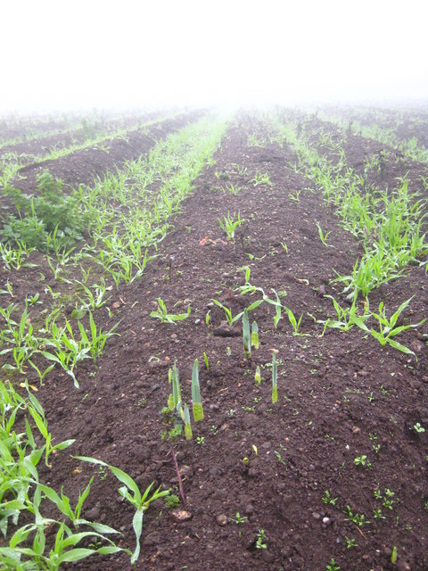
English: Daffodil field at Higher Tremeneer. Shoots are well established in October for the early daffodil crop. |
||
| Date | |||
| Source | geograph.org.uk | ||
| Author | Rod Allday | ||
| Permission (Reusing this file) |
This file is licensed under the Creative Commons Attribution-Share Alike 2.0 Generic license. Attribution: Rod Allday
|
||
| Attribution (required by the license) | Rod Allday / Daffodil field at Higher Tremeneer / | ||

| Camera location | | View this and other nearby images on: OpenStreetMap |
|---|
_heading:135.00&language=en)
| Object location | | View this and other nearby images on: OpenStreetMap |
|---|
_heading:135.00&language=en)
File history
Click on a date/time to view the file as it appeared at that time.
| Date/Time | Thumbnail | Dimensions | User | Comment | |
|---|---|---|---|---|---|
| current | 16:34, 3 March 2011 | | 480 × 640 (116 KB) | GeographBot (talk | contribs) | == {{int:filedesc}} == {{Information |description={{en|1=Daffodil field at Higher Tremeneer Shoots are well established in October for the early daffodil crop.}} |date=2009-10-30 |source=From [http://www.geograph.org.uk/photo/1561641 geograph.org.uk] |aut |
You cannot overwrite this file.
File usage on Commons
There are no pages that use this file.