File:Cz-svk granica.png
Jump to navigation
Jump to search
No higher resolution available.
Cz-svk_granica.png (577 × 366 pixels, file size: 31 KB, MIME type: image/png)
Captions
Captions
Add a one-line explanation of what this file represents
| Description |
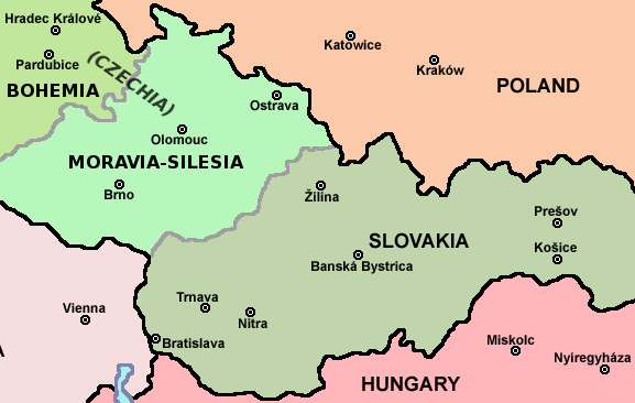
English: Map of Czech-Slovakia border |
| Date | (UTC) |
| Source | |
| Author |
|
| This is a retouched picture, which means that it has been digitally altered from its original version. Modifications: piece of file. The original can be viewed here: Czechoslovakia01.png:
|
I, the copyright holder of this work, hereby publish it under the following license:
| I, the copyright holder of this work, release this work into the public domain. This applies worldwide. In some countries this may not be legally possible; if so: I grant anyone the right to use this work for any purpose, without any conditions, unless such conditions are required by law. |
Original upload log[edit]
This image is a derivative work of the following images:
- File:Czechoslovakia01.png licensed with PD-self
- 2011-04-24T10:38:30Z PANONIAN 1128x513 (63994 Bytes) few corrections
- 2011-04-23T11:31:49Z PANONIAN 1128x509 (62348 Bytes) improved version
- 2008-12-20T20:58:14Z Kirk 1100x497 (80038 Bytes) {{Information |Description= |Source= |Date= |Author= |Permission= |other_versions= }}
- 2006-12-28T16:11:35Z Electionworld 1100x497 (92110 Bytes) {{ew|en|PANONIAN}} Map of {{link|Czechoslovakia}} (self made) Note: The provinces shown on the map were introduced by Act No. 125/1927 Zb. and became effective in 1928. {{PD-self}} [[Category:Maps of Czechoslovakia]] [[Cat
Uploaded with derivativeFX
File history
Click on a date/time to view the file as it appeared at that time.
| Date/Time | Thumbnail | Dimensions | User | Comment | |
|---|---|---|---|---|---|
| current | 17:26, 12 August 2011 | | 577 × 366 (31 KB) | Millenium187 (talk | contribs) | There was a quite significant flaw, today's Czech republic consists of three historical countries: Bohemia, Moravia and Czech Silesia, each of them has its own coat of arms, flag, history, etc. Moravia is not in Bohemia, it's like to say that Scotland is |
| 09:19, 25 April 2011 |  | 577 × 366 (22 KB) | Mixx321 (talk | contribs) | dr | |
| 09:17, 25 April 2011 |  | 577 × 366 (23 KB) | Mixx321 (talk | contribs) | {{Information |Description=* '''English:''' Map of Czech-Slovakia border |Source=*File:Czechoslovakia01.png |Date=2011-04-25 09:15 (UTC) |Author=*File:Czechoslovakia01.png: Electionworld *derivative work: ~~~ |Permission |
You cannot overwrite this file.
File usage on Commons
There are no pages that use this file.
File usage on other wikis
The following other wikis use this file:
- Usage on pl.wikipedia.org