File:Cyprus districts.jpg
Jump to navigation
Jump to search

Size of this preview: 800 × 490 pixels. Other resolutions: 320 × 196 pixels | 640 × 392 pixels | 1,024 × 627 pixels | 1,280 × 783 pixels | 2,560 × 1,567 pixels | 8,610 × 5,270 pixels.
Original file (8,610 × 5,270 pixels, file size: 2.7 MB, MIME type: image/jpeg)
Captions
Captions
Add a one-line explanation of what this file represents
Summary[edit]
| Description |
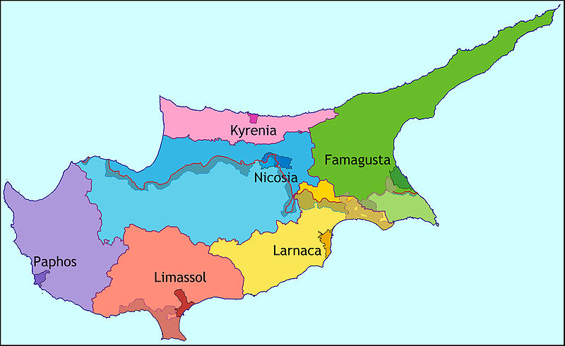
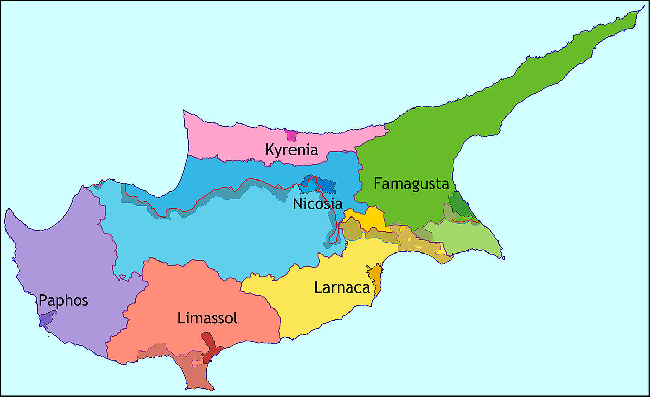
English: Map of Cyprus showing districts |
| Date | |
| Source | Own work |
| Author | Alexander-Michael Hadjilyra |

|
File:Cyprus districts.svg is a vector version of this file. It should be used in place of this JPG file when not inferior.
File:Cyprus districts.jpg → File:Cyprus districts.svg
For more information, see Help:SVG. |
 |
Licensing[edit]
I, the copyright holder of this work, hereby publish it under the following license:
This file is licensed under the Creative Commons Attribution 3.0 Unported license.
- You are free:
- to share – to copy, distribute and transmit the work
- to remix – to adapt the work
- Under the following conditions:
- attribution – You must give appropriate credit, provide a link to the license, and indicate if changes were made. You may do so in any reasonable manner, but not in any way that suggests the licensor endorses you or your use.
File history
Click on a date/time to view the file as it appeared at that time.
| Date/Time | Thumbnail | Dimensions | User | Comment | |
|---|---|---|---|---|---|
| current | 19:47, 2 November 2009 | | 8,610 × 5,270 (2.7 MB) | NeoCy (talk | contribs) | Reverted to version as of 08:37, 5 October 2009 |
| 12:14, 2 November 2009 |  | 8,610 × 5,270 (2.7 MB) | NeoCy (talk | contribs) | better colouring in Buffer Zone and SBAs | |
| 08:37, 5 October 2009 |  | 8,610 × 5,270 (2.7 MB) | NeoCy (talk | contribs) | ||
| 07:12, 9 September 2009 |  | 4,305 × 2,635 (943 KB) | NeoCy (talk | contribs) | {{Information |Description={{en|1=Map of Cyprus showing districts}} |Source=Own work by uploader |Author=Alexander-Michael Hadjilyra |Date=2009-09-09 |Permission= |other_versions= }} |
You cannot overwrite this file.
File usage on Commons
The following 2 pages use this file:
File usage on other wikis
The following other wikis use this file:
- Usage on ast.wikipedia.org
- Usage on bg.wikipedia.org
- Usage on ca.wikipedia.org
- Usage on en.wikipedia.org
- Usage on es.wikipedia.org
- Usage on eu.wikipedia.org
- Usage on fr.wikipedia.org
- Usage on gl.wikipedia.org
- Usage on hyw.wikipedia.org
- Usage on ko.wikipedia.org
- Usage on mt.wikipedia.org
- Usage on nl.wikipedia.org
- Usage on no.wikipedia.org
- Usage on pnb.wikipedia.org
- Usage on ps.wikipedia.org
- Usage on pt.wikipedia.org
- Usage on ro.wikipedia.org
- Usage on sco.wikipedia.org
- Usage on sl.wikipedia.org
- Usage on sv.wikipedia.org
- Usage on tr.wikipedia.org
- Usage on ur.wikipedia.org