File:Cuenca-114-B.svg

Original file (SVG file, nominally 1,884 × 1,692 pixels, file size: 13.35 MB)
Captions
Captions
Summary[edit]
| Description |
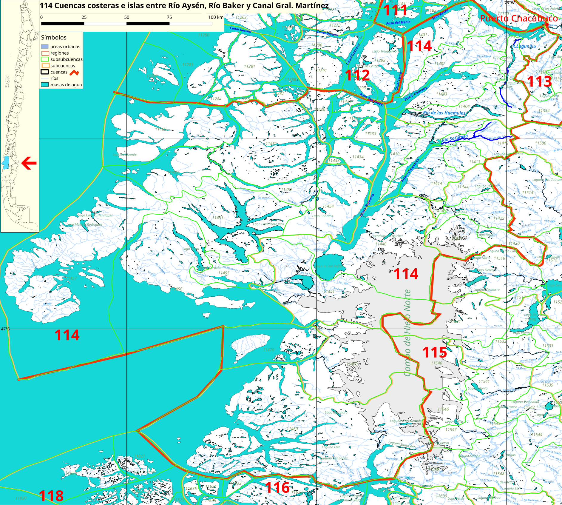
Español: Cuenca 114 (Lago Presidente Ríos, Península de Taitao) del inventario de cuencas de Chile.
Este mapa se elaboró con información extraída de:
Donde BNC, MMA y cedeus significan:
Los datos fueron procesados con QGIS version 2.18.17, exportados al formato SVG con las opciones "render map labels as outlines" desconectada pero "export map layers as svg groups" conectada. Con Inkscape 0.92 se eliminó la excesiva repetición de nombres, los nombres fueron colocados paralelos a los ríos o lagos y en lugares más visibles. Nombres y números que el editor no pudo asociar a objeto alguno fueron borrados. Finalmente se redujo el volumen de datos por medio de svgo (svg-optimizer). |
| Date | |
| Source | Own work |
| Author | Juan Villalobos |
| SVG development |
Licensing[edit]
- You are free:
- to share – to copy, distribute and transmit the work
- to remix – to adapt the work
- Under the following conditions:
- attribution – You must give appropriate credit, provide a link to the license, and indicate if changes were made. You may do so in any reasonable manner, but not in any way that suggests the licensor endorses you or your use.
- share alike – If you remix, transform, or build upon the material, you must distribute your contributions under the same or compatible license as the original.
File history
Click on a date/time to view the file as it appeared at that time.
| Date/Time | Thumbnail | Dimensions | User | Comment | |
|---|---|---|---|---|---|
| current | 20:14, 4 October 2019 | | 1,884 × 1,692 (13.35 MB) | Juan Villalobos (talk | contribs) | nombres de canales, + rios |
| 08:18, 10 June 2019 |  | 1,884 × 1,692 (6.47 MB) | Juan Villalobos (talk | contribs) | svgcleaner, mar azul | |
| 21:36, 19 February 2019 |  | 2,010 × 1,804 (5.83 MB) | Juan Villalobos (talk | contribs) | User created page with UploadWizard |
You cannot overwrite this file.
File usage on Commons
The following page uses this file:
File usage on other wikis
The following other wikis use this file:
- Usage on arz.wikipedia.org
- Usage on es.wikipedia.org
- Campo de hielo patagónico norte
- Laguna San Rafael
- Lago Presidente Ríos
- Categoría:Cuencas costeras e islas entre Río Aysén, Río Baker y Canal Gral. Martínez (114)
- Río Sorpresa
- Río Huemules (Tres Cruces)
- Río Lagunillas
- Río Exploradores
- Río Lucac
- Santuario de la naturaleza Estero de Quitralco
- Río Huemules (Steffen)
- Estero Newman
- Lago Elena
- Río Aldunate
- Laguna Témpanos (glaciar Steffen)
- Cuencas costeras e islas entre río Aysén, río Baker y canal Gral. Martínez
- Río Acodado
- Lago Bayo
- Lago Camilo Henríquez
- Lago Manuel Rodríguez
- Usage on www.wikidata.org