File:Cube House (208493489).jpeg
Jump to navigation
Jump to search

Size of this preview: 800 × 534 pixels. Other resolutions: 320 × 213 pixels | 640 × 427 pixels | 1,024 × 683 pixels | 1,280 × 854 pixels | 2,048 × 1,366 pixels.
Original file (2,048 × 1,366 pixels, file size: 609 KB, MIME type: image/jpeg)
Captions
Captions
Add a one-line explanation of what this file represents
Summary[edit]
.jpeg&action=edit§ion=1)
| Cube House | |
|---|---|
| Photographer | |
| Title |
Cube House |
| Description |
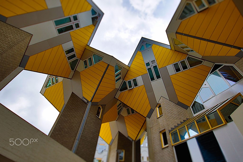
500px provided description: (Dutch: Kubuswoningen) are a set of innovative houses built in Rotterdam and Helmond in the Netherlands, designed by architect Piet Blom and based on the concept of "living as an urban roof": high density housing with sufficient space on the ground level, since its main purpose is to optimize the space inside. Blom tilted the cube of a conventional house 45 degrees, and rested it upon a hexagon-shaped pylon. His design represents a village within a city, where each house represents a tree, and all the houses together, a forest. The central idea of the cube houses around the world is mainly optimizing the space, as a house, to a better distribution of the rooms inside [#yellow ,#sky ,#city ,#sunset ,#street ,#travel ,#blue ,#light ,#clouds ,#house ,#urban ,#architecture ,#building ,#white ,#holland ,#netherlands ,#cube ,#Kubuswoningen] |
| Date | before 19 April 2017, 23:49:53 (UTC) |
| Source | Imported from 500px (archived version) by the Archive Team. (detail page) |
| Permission (Reusing this file) |
This file is licensed under the Creative Commons Attribution-Share Alike 3.0 Unported license.
|
| Camera location | | View this and other nearby images on: OpenStreetMap |
|---|
.jpeg¶ms=051.920158_N_0004.490702_E_globe:Earth_type:camera__&language=en)
File history
Click on a date/time to view the file as it appeared at that time.
| Date/Time | Thumbnail | Dimensions | User | Comment | |
|---|---|---|---|---|---|
| current | 06:09, 12 January 2019 | | 2,048 × 1,366 (609 KB) | DarwIn (talk | contribs) | Photo Cube House imported from 500px with import-500px |
You cannot overwrite this file.
File usage on Commons
The following page uses this file:
.jpeg)
.jpeg&oldid=871752050)