File:Crowsnest Pass Communities.png
Jump to navigation
Jump to search

Size of this preview: 776 × 600 pixels. Other resolutions: 311 × 240 pixels | 621 × 480 pixels | 994 × 768 pixels | 1,280 × 989 pixels | 2,560 × 1,978 pixels | 3,300 × 2,550 pixels.
Original file (3,300 × 2,550 pixels, file size: 4.35 MB, MIME type: image/png)
Captions
Captions
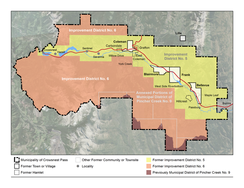
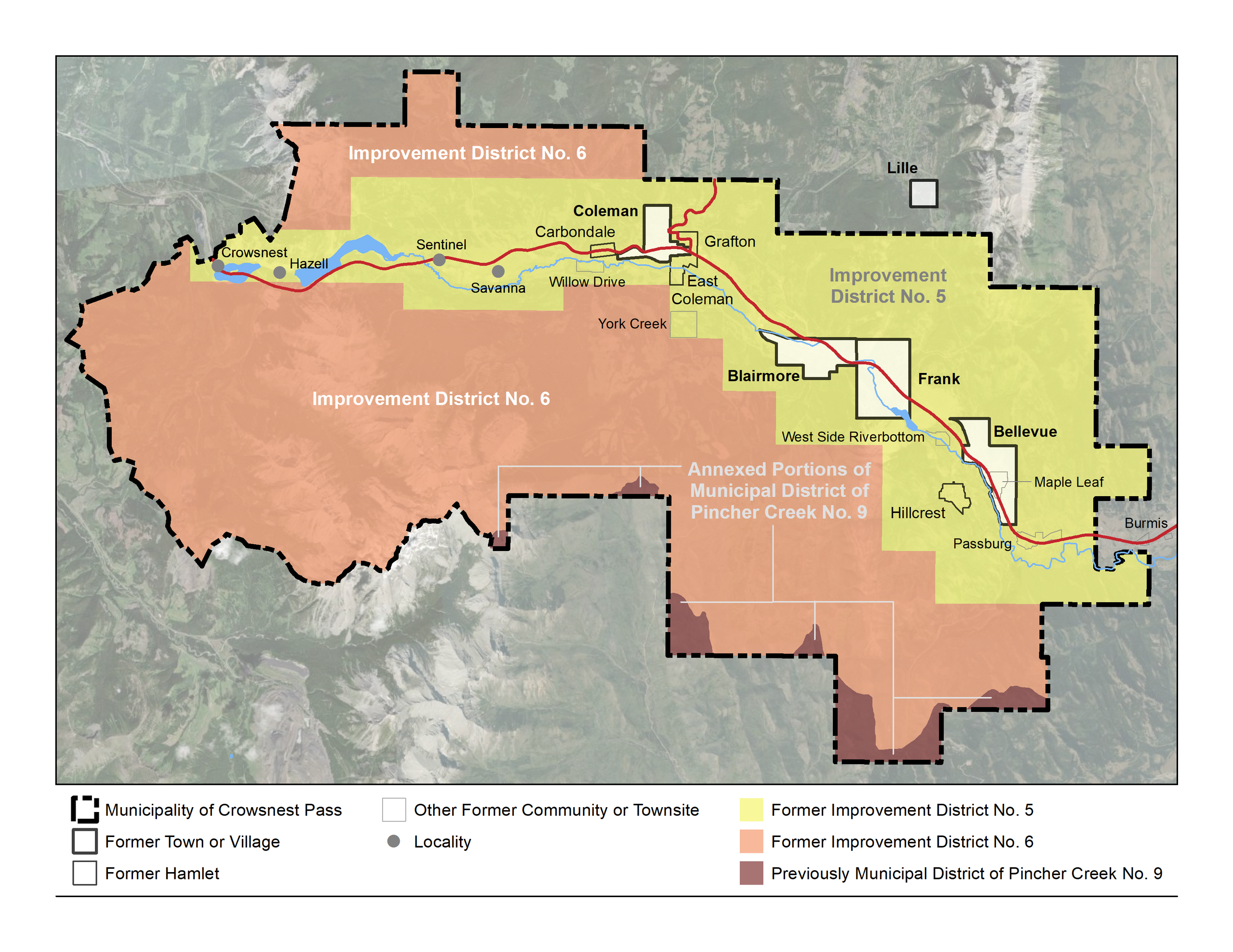
Former municipalities and unincorporated communities in the Municipality of Crowsnest Pass
Summary[edit]
| Description |
English: Approximate boundaries of the former urban municipalities (towns of Blairmore and Coleman and villages of Bellevue and Frank) and improvement districts (ID No. 5 and ID No. 6) that comprise the Municipality of Crowsnest Pass; approximate boundaries/locations of former unincorporated urban communities/townsites (Hillcrest, East Coleman, Grafton, Carbondale, Passburg, Sentinal, Hazell, Crowsnest, Willow Drive, and York Creek) within what were previously improvement districts; and approximate boundaries of the former Village of Lille and the former Burmis townsite that are just beyond the boundary of the Municipality of Crowsnest Pass but are intrinsicly linked to the history of the Crowsnest Pass area. |
| Date | |
| Source | Own work |
| Author | Hwy43 |
Licensing[edit]
I, the copyright holder of this work, hereby publish it under the following license:
This file is licensed under the Creative Commons Attribution 3.0 Unported license.
- You are free:
- to share – to copy, distribute and transmit the work
- to remix – to adapt the work
- Under the following conditions:
- attribution – You must give appropriate credit, provide a link to the license, and indicate if changes were made. You may do so in any reasonable manner, but not in any way that suggests the licensor endorses you or your use.
File history
Click on a date/time to view the file as it appeared at that time.
| Date/Time | Thumbnail | Dimensions | User | Comment | |
|---|---|---|---|---|---|
| current | 19:47, 2 November 2021 | | 3,300 × 2,550 (4.35 MB) | Hwy43 (talk | contribs) | fix Maple Leaf label and Savanna label adjustment |
| 05:18, 2 November 2021 |  | 1,056 × 816 (799 KB) | Hwy43 (talk | contribs) | add fourth locality (Savanna), highways, and some hydrography | |
| 02:48, 2 November 2021 |  | 1,056 × 816 (787 KB) | Hwy43 (talk | contribs) | added West Side Riverbottom and Maple | |
| 06:26, 28 October 2021 |  | 972 × 736 (800 KB) | Hwy43 (talk | contribs) | Uploaded own work with UploadWizard |
You cannot overwrite this file.
File usage on Commons
There are no pages that use this file.
File usage on other wikis
The following other wikis use this file:
- Usage on en.wikipedia.org