File:Crookston Minnesota aerial view.jpg
Jump to navigation
Jump to search
Size of this preview: 800 × 562 pixels. Other resolutions: 320 × 225 pixels | 640 × 449 pixels | 1,024 × 719 pixels | 1,280 × 899 pixels | 1,500 × 1,053 pixels.
Original file (1,500 × 1,053 pixels, file size: 820 KB, MIME type: image/jpeg)
Captions
Captions
Add a one-line explanation of what this file represents
| Description |
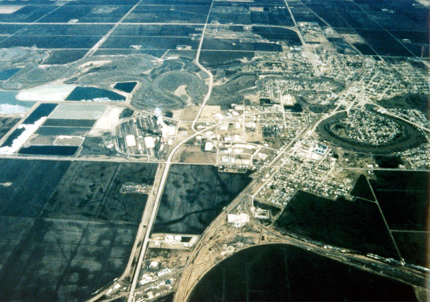
English: Aerial view of Crookston, Minnesota, USA. The Red Lake River twists and turns on its way through the city. The Red Lake River runs west-northwest to join the Red River about 22 miles (straight line) west of Crookston at Grand Forks, North Dakota (hence the name Grand Forks). |
|||
| Date | ||||
| Source |
U.S. Army Corps of Engineers Digital Visual Library Image page Image description page Digital Visual Library home page |
|||
| Author | Tom Crump, U.S. Army Corps of Engineers | |||
| Permission (Reusing this file) |
|
|||
| Location | Crookston, Minnesota, USA |
| Camera location | | View this and other nearby images on: OpenStreetMap |
|---|
File history
Click on a date/time to view the file as it appeared at that time.
| Date/Time | Thumbnail | Dimensions | User | Comment | |
|---|---|---|---|---|---|
| current | 03:47, 7 April 2007 | | 1,500 × 1,053 (820 KB) | DanMS (talk | contribs) | {{Information | Description = {{en|Aerial view of Crookston, Minnesota, USA. The Red Lake River twists and turns on its way through the city. The Red Lake River runs west-northwest to join the Red River about 22 miles (straight line) west of Crookston |
You cannot overwrite this file.
File usage on Commons
There are no pages that use this file.
File usage on other wikis
The following other wikis use this file:
- Usage on de.wikipedia.org
- Usage on en.wikipedia.org
- Usage on he.wikipedia.org
- Usage on it.wikipedia.org
- Usage on nn.wikipedia.org
- Usage on pl.wikipedia.org