File:Corridors TCSP Rennes.png
Jump to navigation
Jump to search
Size of this preview: 542 × 600 pixels. Other resolutions: 217 × 240 pixels | 434 × 480 pixels | 801 × 886 pixels.
Original file (801 × 886 pixels, file size: 1.3 MB, MIME type: image/png)
Captions
Captions
Add a one-line explanation of what this file represents
Summary[edit]
| Description |
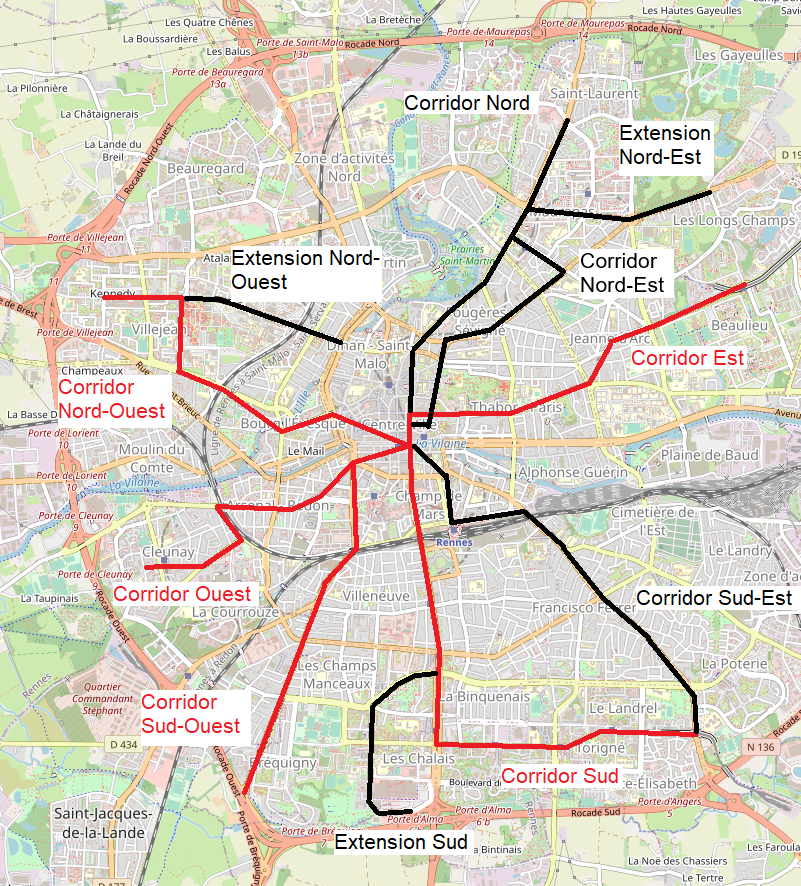
Français : Cartes des corridors TCSP de Rennes selon l'étude préliminaire de 1986, avec en rouges ceux qui ont été privilégiés. |
| Date | |
| Source | OpenStreetMap |
| Author |
own work, using
|
Licensing[edit]
| This work contains information from OpenStreetMap, which is made available under the Open Database License (ODbL).
The ODbL does not require any particular license for maps produced from ODbL data. Prior to 1 August 2020, map tiles produced by the OpenStreetMap Foundation were licensed under the CC-BY-SA-2.0 license. Maps produced by other people may be subject to other licences. |
File history
Click on a date/time to view the file as it appeared at that time.
| Date/Time | Thumbnail | Dimensions | User | Comment | |
|---|---|---|---|---|---|
| current | 20:06, 7 September 2023 | | 801 × 886 (1.3 MB) | Lyon-St-Clair (talk | contribs) | oubli d'un corridor |
| 18:09, 18 March 2023 |  | 801 × 886 (1.31 MB) | Lyon-St-Clair (talk | contribs) | Uploaded a work by own work, using * [http://www.openstreetmap.org OpenStreetMap] data for the background from OpenStreetMap with UploadWizard |
You cannot overwrite this file.
File usage on Commons
The following 4 pages use this file:
File usage on other wikis
The following other wikis use this file:
- Usage on fr.wikipedia.org