File:Copper alloy bell of probable postmedieval date (FindID 176905).jpg
Jump to navigation
Jump to search
Size of this preview: 571 × 600 pixels. Other resolutions: 229 × 240 pixels | 457 × 480 pixels | 731 × 768 pixels | 975 × 1,024 pixels | 1,895 × 1,990 pixels.
Original file (1,895 × 1,990 pixels, file size: 653 KB, MIME type: image/jpeg)
Captions
Captions
Add a one-line explanation of what this file represents
Summary
[edit].jpg&action=edit§ion=1)
| Copper alloy bell of probable postmedieval date | |||
|---|---|---|---|
| Photographer |
Northamptonshire County Council, Steven Ashby, 2007-06-06 18:02:53 |
||
| Title |
Copper alloy bell of probable postmedieval date |
||
| Description |
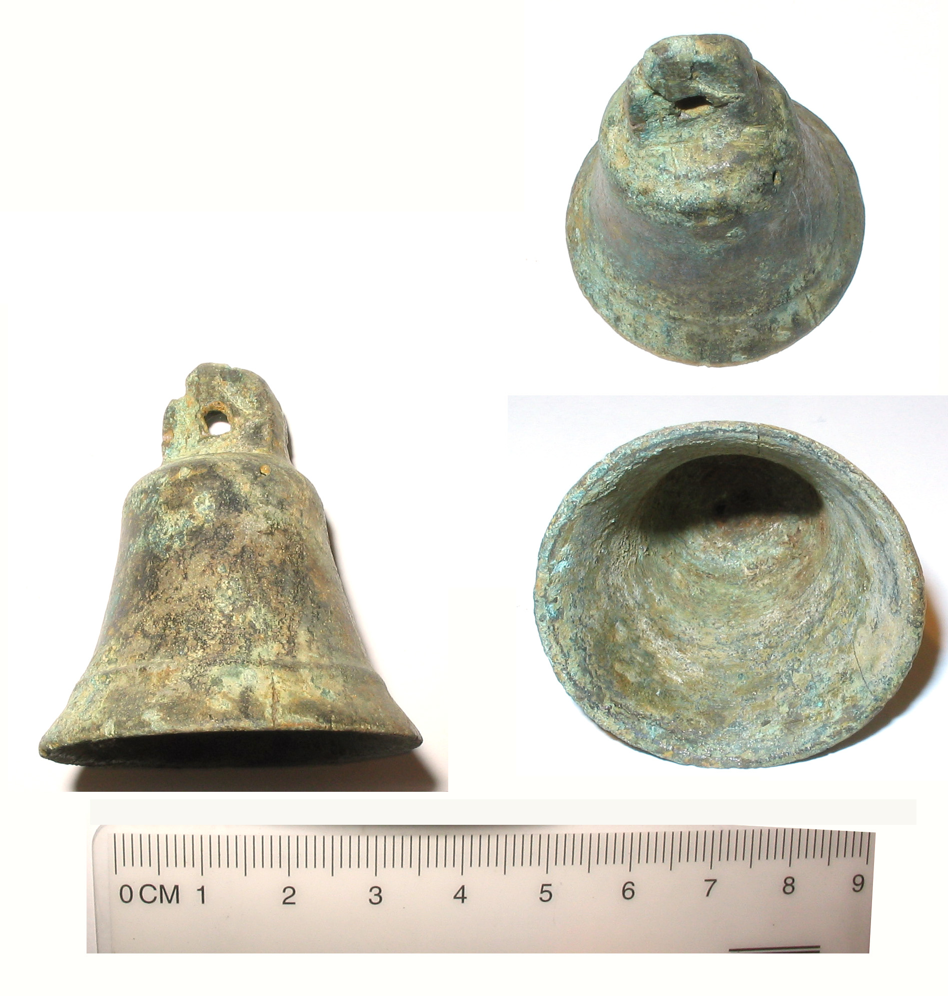
English: A cast copper alloy bell. The clapper is missing. The bell's profile is rather angular, with concave sides, a flat apex, and a relatively narrow opening at the base. The bell's walls are relatively thin, and it has a long, thin form, with a large, broadly oval suspension loop of rectangular section, with a circular perforation. The bell is decorated around the outer rim with a single circumferential line. The surface has developed a patchy grey-green patina.
This bell measures 45mm in height, 37mm in maximum diameter, and weighs 30g. The walls are 1.74mm thick. It is postmedieval in date. |
||
| Depicted place | (County of findspot) Northamptonshire | ||
| Date | between 1500 and 1900 | ||
| Accession number |
FindID: 176905 Old ref: NARC-B93FE2 Filename: NARC-B93FE2 copper alloy bell.JPG |
||
| Credit line |
|
||
| Source |
https://finds.org.uk/database/ajax/download/id/140704 Catalog: https://finds.org.uk/database/images/image/id/140704/recordtype/artefacts archive copy at the Wayback Machine Artefact: https://finds.org.uk/database/artefacts/record/id/176905 |
||
| Permission (Reusing this file) |
Attribution-ShareAlike License | ||
| Object location | | View this and other nearby images on: OpenStreetMap |
|---|
.jpg¶ms=052.205700_N_-000.895692_E_globe:Earth_class:object_type:object__&language=en)
Licensing
[edit].jpg&action=edit§ion=2)
This file is licensed under the Creative Commons Attribution-Share Alike 2.0 Generic license.
Attribution: The Portable Antiquities Scheme/ The Trustees of the British Museum
- You are free:
- to share – to copy, distribute and transmit the work
- to remix – to adapt the work
- Under the following conditions:
- attribution – You must give appropriate credit, provide a link to the license, and indicate if changes were made. You may do so in any reasonable manner, but not in any way that suggests the licensor endorses you or your use.
- share alike – If you remix, transform, or build upon the material, you must distribute your contributions under the same or compatible license as the original.
File history
Click on a date/time to view the file as it appeared at that time.
| Date/Time | Thumbnail | Dimensions | User | Comment | |
|---|---|---|---|---|---|
| current | 22:00, 26 January 2017 | | 1,895 × 1,990 (653 KB) | Fæ (talk | contribs) | Portable Antiquities Scheme, RESEARCH, FindID: 176905, post medieval, page 520, batch count 1218 |
You cannot overwrite this file.
File usage on Commons
The following page uses this file:
.jpg)
.jpg&oldid=868184174)