File:Comoros country map 1976, CIA.jpg
Jump to navigation
Jump to search

Size of this preview: 800 × 519 pixels. Other resolutions: 320 × 207 pixels | 640 × 415 pixels | 1,024 × 664 pixels | 1,348 × 874 pixels.
Original file (1,348 × 874 pixels, file size: 198 KB, MIME type: image/jpeg)
Captions
Captions
Add a one-line explanation of what this file represents
Summary[edit]
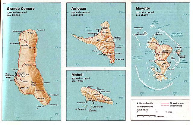
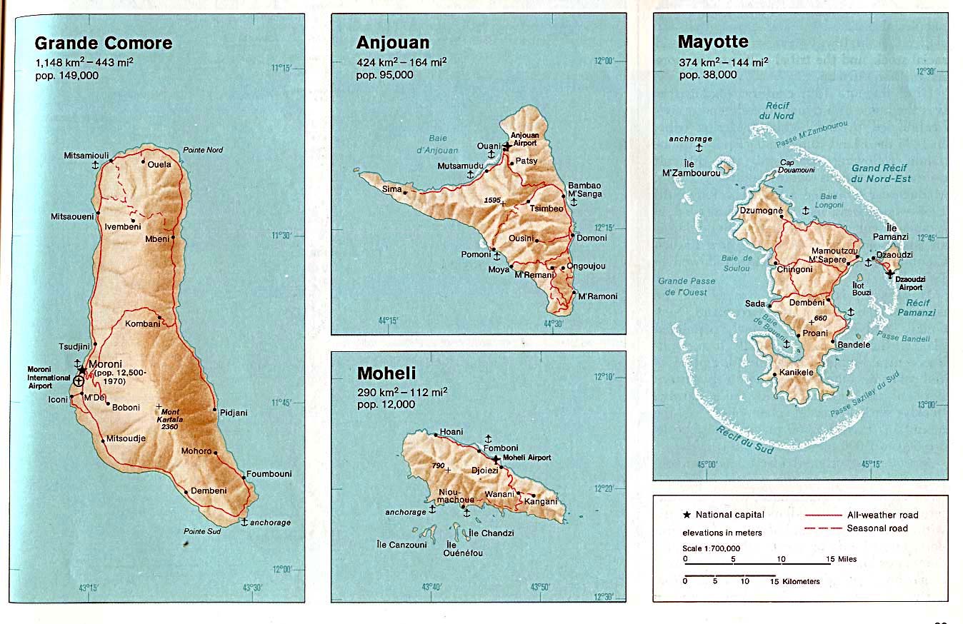
| Description | Country Map of the Comoros (Grande Comore, Anjouan, Moheli, Mayotte). From The Indian Ocean Atlas, CIA, 1976. |
| Date | |
| Source | University of Texas Libraries, Perry-Castañeda Library Map Collection: Comoros Maps |
| Author | CIA |
| Other versions |
|
_map.jpg)
_map.jpg)
_map.jpg)

Licensing[edit]
| This image is a work of a Central Intelligence Agency employee, taken or made as part of that person's official duties. As a Work of the United States Government, this image or media is in the public domain in the United States.
|

|
File history
Click on a date/time to view the file as it appeared at that time.
| Date/Time | Thumbnail | Dimensions | User | Comment | |
|---|---|---|---|---|---|
| current | 22:15, 17 July 2010 | | 1,348 × 874 (198 KB) | Martin H. (talk | contribs) | == {{int:filedesc}} == {{Information |Description= Country Map of Comoros (Grande Comore, Anjouan, Moheli, Mayotte). From The Indian Ocean Atlas, CIA, 1976. |Source= University of Texas Libraries, Perry-Castañeda Library Map Collection: [http://www.lib.u |
You cannot overwrite this file.
File usage on Commons
The following 5 pages use this file:
File usage on other wikis
The following other wikis use this file:
- Usage on cs.wikipedia.org
- Usage on mg.wikipedia.org
- Usage on uk.wikipedia.org