File:Commuter Megaregions of the United States (map 6.png).png
Jump to navigation
Jump to search
Size of this preview: 800 × 566 pixels. Other resolutions: 320 × 226 pixels | 640 × 453 pixels | 1,024 × 724 pixels | 1,280 × 905 pixels | 2,560 × 1,810 pixels | 3,507 × 2,480 pixels.
Original file (3,507 × 2,480 pixels, file size: 11.27 MB, MIME type: image/png)
Captions
Captions
Add a one-line explanation of what this file represents
Summary[edit]
.png&action=edit§ion=1)
| Description |
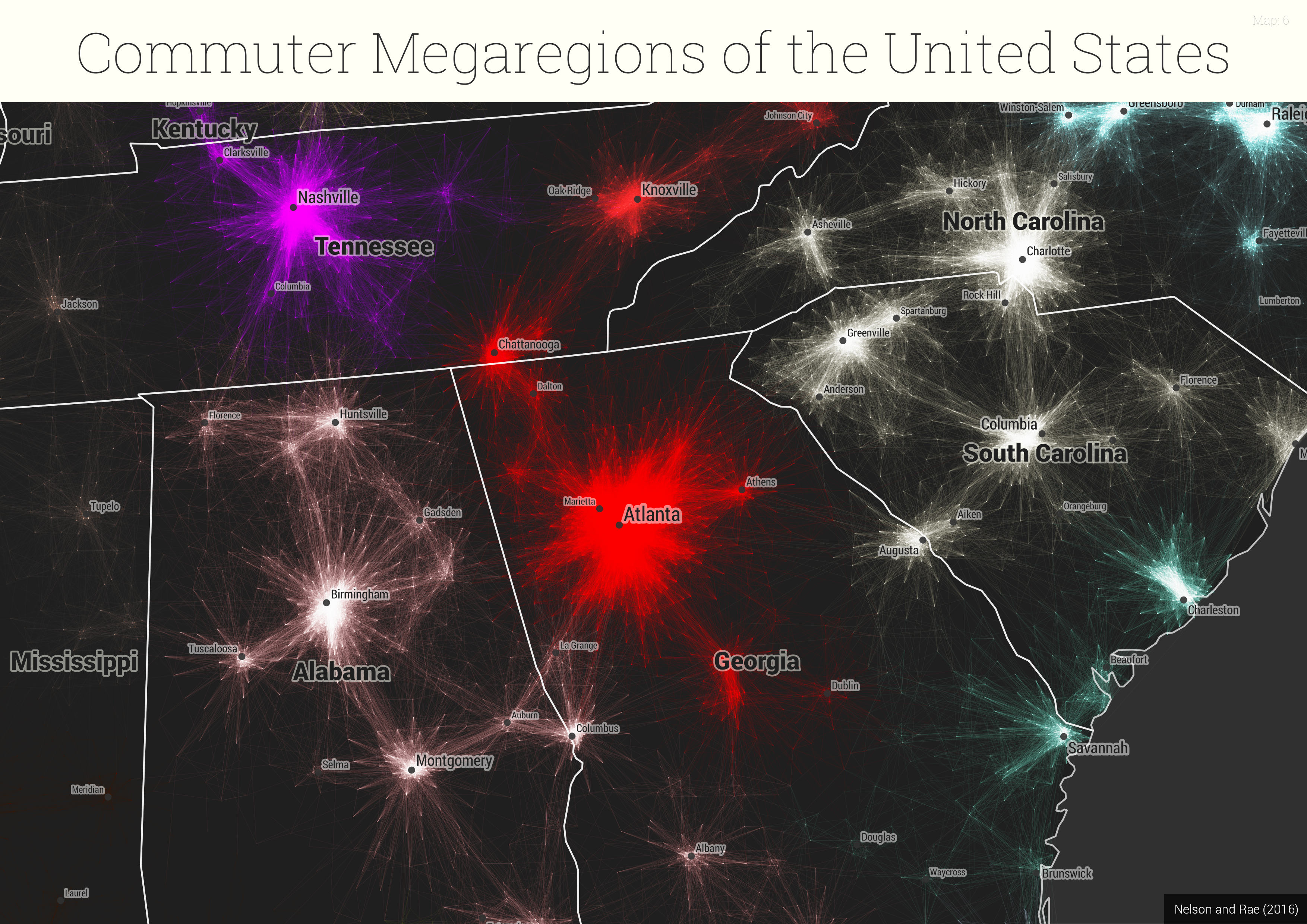
English: One of a series of maps provided as high resolution PNGs as part of a dataset:
Rae, Alasdair; Nelson, Garrett G.D. (2017): United States Commutes and Megaregions data for GIS. figshare. Fileset https://doi.org/10.15131/shef.data.4110156.v5 Files created by and used in a related PLOS ONE paper, entitled 'An economic geography of the United States: from commutes to megaregions', by Garrett Dash Nelson and Alasdair Rae, published 30 November 2016 https://dx.doi.org/10.1371/journal.pone.0166083 |
| Date | |
| Source | https://doi.org/10.15131/shef.data.4110156.v5 |
| Author | Alasdair Rae, Garrett G.D. Nelson |
Licensing[edit]
.png&action=edit§ion=2)
This file is licensed under the Creative Commons Attribution-Share Alike 4.0 International license.
- You are free:
- to share – to copy, distribute and transmit the work
- to remix – to adapt the work
- Under the following conditions:
- attribution – You must give appropriate credit, provide a link to the license, and indicate if changes were made. You may do so in any reasonable manner, but not in any way that suggests the licensor endorses you or your use.
- share alike – If you remix, transform, or build upon the material, you must distribute your contributions under the same or compatible license as the original.
File history
Click on a date/time to view the file as it appeared at that time.
| Date/Time | Thumbnail | Dimensions | User | Comment | |
|---|---|---|---|---|---|
| current | 10:48, 14 August 2018 | | 3,507 × 2,480 (11.27 MB) | OAnick (talk | contribs) | User created page with UploadWizard |
You cannot overwrite this file.
File usage on Commons
There are no pages that use this file.
.png&oldid=866673192)