File:Columbia River (MODIS 2019-06-21).jpg

Original file (2,048 × 1,617 pixels, file size: 598 KB, MIME type: image/jpeg)
Captions
Captions
Summary[edit]
.jpg&action=edit§ion=1)
| Description |
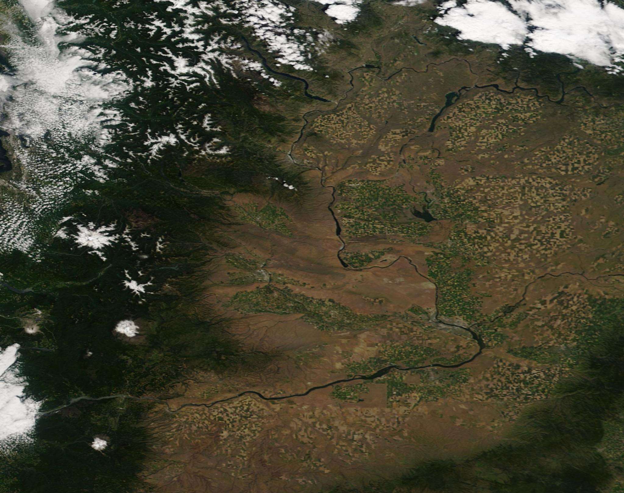
English: The Columbia River, the largest river in the Pacific Northwest, rises from Columbia Lake high near the crest of the Rocky Mountains in British Columbia, Canada. Flowing northwesterly for about 190 miles (305 km), the river then turns south to cross the border between Canada and the United States, and then sweeps across the state of Washington in a sweeping curve before forming the boundary between Washington and Oregon. Heading towards the mountains, the Columbia River cuts through the Cascades at the Columbia River Gorge on its way to pour into the Pacific Ocean. It is the only river to cut through the Cascade Range.
Many dams built along the river provide hydroelectric power to the region. The Columbia is also famous for its annual run of salmon as steelhead, providing fishing opportunities as the fish swim north to breed and renew their population. Unfortunately, the numbers of salmon and steelhead returning to this river has been dropping, with the 2019 salmon run poor enough to prompt Oregon and Washington Departments of Fish and Wildlife to close Chinook salmon fishing in the Columbia River in May. Bag limits for all salmon and steelhead, other than Coho salmon, will also be reduced. On June 15, 2019, the Moderate Resolution Imaging Spectroradiometer (MODIS) on board NASA’s Terra satellite acquired a true-color image of the Columbia River as it snakes it way across Washington’s relatively dry Columbia Plateau and enters the Columbia Gorge in the heavily vegetated and green Cascades Mountains. |
||
| Date | Taken on 15 June 2019 | ||
| Source |
|
||
| Author | MODIS Land Rapid Response Team, NASA GSFC |
| This media is a product of the Terra mission Credit and attribution belongs to the mission team, if not already specified in the "author" row |
Licensing[edit]
.jpg&action=edit§ion=2)
| This file is in the public domain in the United States because it was solely created by NASA. NASA copyright policy states that "NASA material is not protected by copyright unless noted". (See Template:PD-USGov, NASA copyright policy page or JPL Image Use Policy.) | ||
 |
Warnings:
|
File history
Click on a date/time to view the file as it appeared at that time.
| Date/Time | Thumbnail | Dimensions | User | Comment | |
|---|---|---|---|---|---|
| current | 03:15, 17 February 2024 | | 2,048 × 1,617 (598 KB) | OptimusPrimeBot (talk | contribs) | #Spacemedia - Upload of http://modis.gsfc.nasa.gov/gallery/images/image06212019_250m.jpg via Commons:Spacemedia |
You cannot overwrite this file.
File usage on Commons
There are no pages that use this file.
.jpg&oldid=852711569)