File:City plan of Antwerp (Stappaers, 1945).jpg
Jump to navigation
Jump to search

Size of this preview: 413 × 600 pixels. Other resolutions: 165 × 240 pixels | 330 × 480 pixels | 529 × 768 pixels | 705 × 1,024 pixels | 1,410 × 2,048 pixels | 8,603 × 12,491 pixels.
Original file (8,603 × 12,491 pixels, file size: 123.86 MB, MIME type: image/jpeg)
Captions
Captions
Add a one-line explanation of what this file represents
Summary[edit]
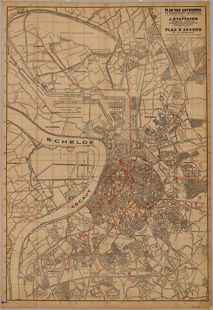
| Title |
Nederlands: Antwerpen en randgemeenten ca. 1945 [ca. 1:16000] |
||||||||||||||
| Description |
Nederlands: Inventaris nummer : 12#8881 |
||||||||||||||
| Date | |||||||||||||||
| Source |
|
||||||||||||||
| Creator |
J Stappaers |
||||||||||||||
| Permission (Reusing this file) |
|
||||||||||||||
| Geotemporal data | |||||||||||||||
| Date depicted | |||||||||||||||
| Georeferencing | If inappropriate please set warp_status = skip to hide. | ||||||||||||||

.jpg&action=edit§ion=1)
Licensing[edit]
.jpg&action=edit§ion=2)
The FelixArchief has determined this item is in Belgium's public domain.
Public domain works must be out of copyright in the United States and in the source country, and must be accompanied one or more valid copyright tags to indicate its status. Absence of such tags may result in a file's deletion.
|
File history
Click on a date/time to view the file as it appeared at that time.
| Date/Time | Thumbnail | Dimensions | User | Comment | |
|---|---|---|---|---|---|
| current | 15:45, 9 September 2022 | | 8,603 × 12,491 (123.86 MB) | Arflhn (talk | contribs) | Uploaded own work with UploadWizard |
You cannot overwrite this file.
File usage on Commons
The following 3 pages use this file:
.jpg&oldid=861486774)