File:Chlorophyll Concentration.jpg
Jump to navigation
Jump to search
Size of this preview: 800 × 566 pixels. Other resolutions: 320 × 226 pixels | 640 × 452 pixels | 1,000 × 707 pixels.
Original file (1,000 × 707 pixels, file size: 458 KB, MIME type: image/jpeg)
Captions
Captions
Add a one-line explanation of what this file represents
Summary[edit]
| Description |
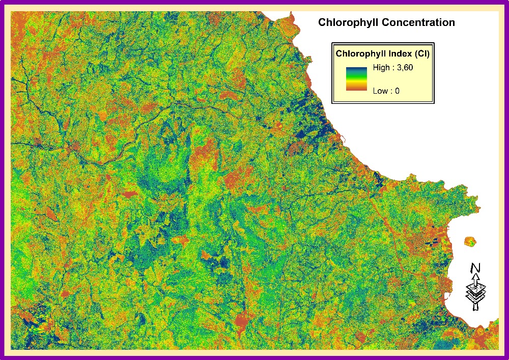
English: Chlorophyll Index CI. Unit of measure is not defined sometimes in vegetation indices with remote sensing methods, however, is a valid way to identify the areas with maximum, medium and minimum Vigor. Values from 0 to 3.60 are bare soils and crops respectively. The eastern and northern areas of olive orchards are more robust with respect to the western lands. |
| Date | |
| Source | Own work |
| Author | Human & Physical Geography |
Licensing[edit]
I, the copyright holder of this work, hereby publish it under the following license:
This file is licensed under the Creative Commons Attribution-Share Alike 4.0 International license.
- You are free:
- to share – to copy, distribute and transmit the work
- to remix – to adapt the work
- Under the following conditions:
- attribution – You must give appropriate credit, provide a link to the license, and indicate if changes were made. You may do so in any reasonable manner, but not in any way that suggests the licensor endorses you or your use.
- share alike – If you remix, transform, or build upon the material, you must distribute your contributions under the same or compatible license as the original.
| This image was uploaded as part of European Science Photo Competition 2015. |
File history
Click on a date/time to view the file as it appeared at that time.
| Date/Time | Thumbnail | Dimensions | User | Comment | |
|---|---|---|---|---|---|
| current | 22:49, 25 November 2015 | | 1,000 × 707 (458 KB) | Human & Physical Geography (talk | contribs) | User created page with UploadWizard |
You cannot overwrite this file.
File usage on Commons
There are no pages that use this file.