File:Chile.topografico.regiones-maule-ohiggins.png
Jump to navigation
Jump to search

Size of this preview: 649 × 599 pixels. Other resolutions: 260 × 240 pixels | 520 × 480 pixels | 832 × 768 pixels | 1,109 × 1,024 pixels | 2,148 × 1,984 pixels.
Original file (2,148 × 1,984 pixels, file size: 7.43 MB, MIME type: image/png)
Captions
Captions
Add a one-line explanation of what this file represents
Summary[edit]
| Description |
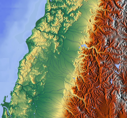
Español: mapa topográfico de alta resolución de las regiones de Maule y Bio-bio, desde Curicó hasta Coronel |
| Date | |
| Source | http://www.maps-for-free.com |
| Author | http://www.maps-for-free.com |
Licensing[edit]

|
Permission is granted to copy, distribute and/or modify this document under the terms of the GNU Free Documentation License, Version 1.2 only as published by the Free Software Foundation; with no Invariant Sections, no Front-Cover Texts, and no Back-Cover Texts. A copy of the license is included in the section entitled GNU Free Documentation License. | 1.2 only |
File history
Click on a date/time to view the file as it appeared at that time.
| Date/Time | Thumbnail | Dimensions | User | Comment | |
|---|---|---|---|---|---|
| current | 18:26, 5 June 2012 | | 2,148 × 1,984 (7.43 MB) | Keysanger (talk | contribs) |
You cannot overwrite this file.
File usage on Commons
There are no pages that use this file.