File:Chickfila location distribution.svg
Jump to navigation
Jump to search

Size of this PNG preview of this SVG file: 555 × 352 pixels. Other resolutions: 320 × 203 pixels | 640 × 406 pixels | 1,024 × 649 pixels | 1,280 × 812 pixels | 2,560 × 1,624 pixels.
Original file (SVG file, nominally 555 × 352 pixels, file size: 1.86 MB)
Captions
Captions
Add a one-line explanation of what this file represents
Summary[edit]
| Description |
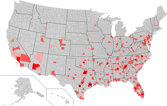
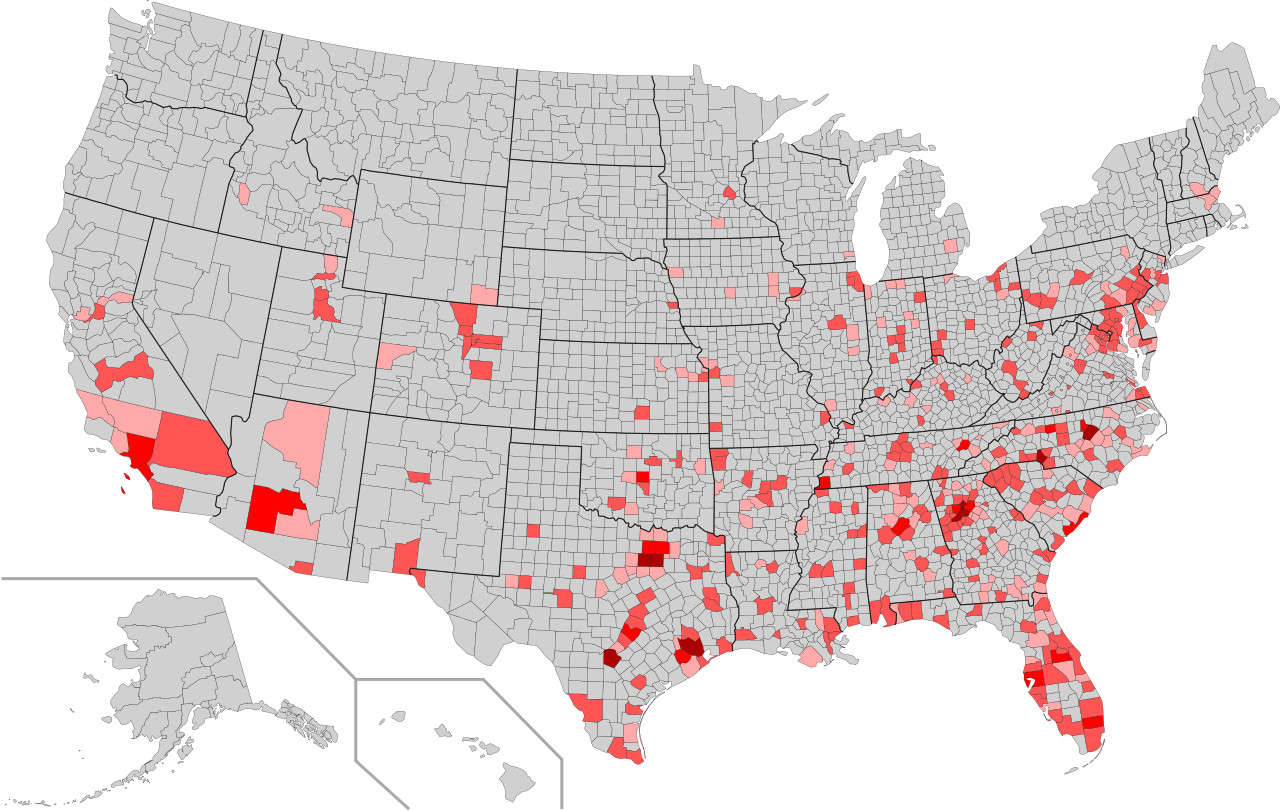
English: Distribution of Chick-fil-a locations in the U.S. by county.
Light pink = 1 store |
| Date | |
| Source |
http://en.wikipedia.org/wiki/File:USA_Counties_with_FIPS_and_names.svg, Location Data |
| Author |
haha169: Coloring Mr. Matté and Kbh3rd: Map |
Licensing[edit]
I, the copyright holder of this work, hereby publish it under the following license:
| I, the copyright holder of this work, release this work into the public domain. This applies worldwide. In some countries this may not be legally possible; if so: I grant anyone the right to use this work for any purpose, without any conditions, unless such conditions are required by law. |
File history
Click on a date/time to view the file as it appeared at that time.
| Date/Time | Thumbnail | Dimensions | User | Comment | |
|---|---|---|---|---|---|
| current | 07:32, 30 July 2012 | | 555 × 352 (1.86 MB) | Haha169 (talk | contribs) |
You cannot overwrite this file.
File usage on Commons
There are no pages that use this file.