File:Chiba Prefectural Baseball Stadium, GSI 2019.jpg
Jump to navigation
Jump to search

Size of this preview: 800 × 600 pixels. Other resolutions: 320 × 240 pixels | 640 × 480 pixels | 1,024 × 768 pixels | 1,280 × 960 pixels | 1,500 × 1,125 pixels.
Original file (1,500 × 1,125 pixels, file size: 493 KB, MIME type: image/jpeg)
Captions
Captions
Add a one-line explanation of what this file represents
Summary[edit]
| Description |
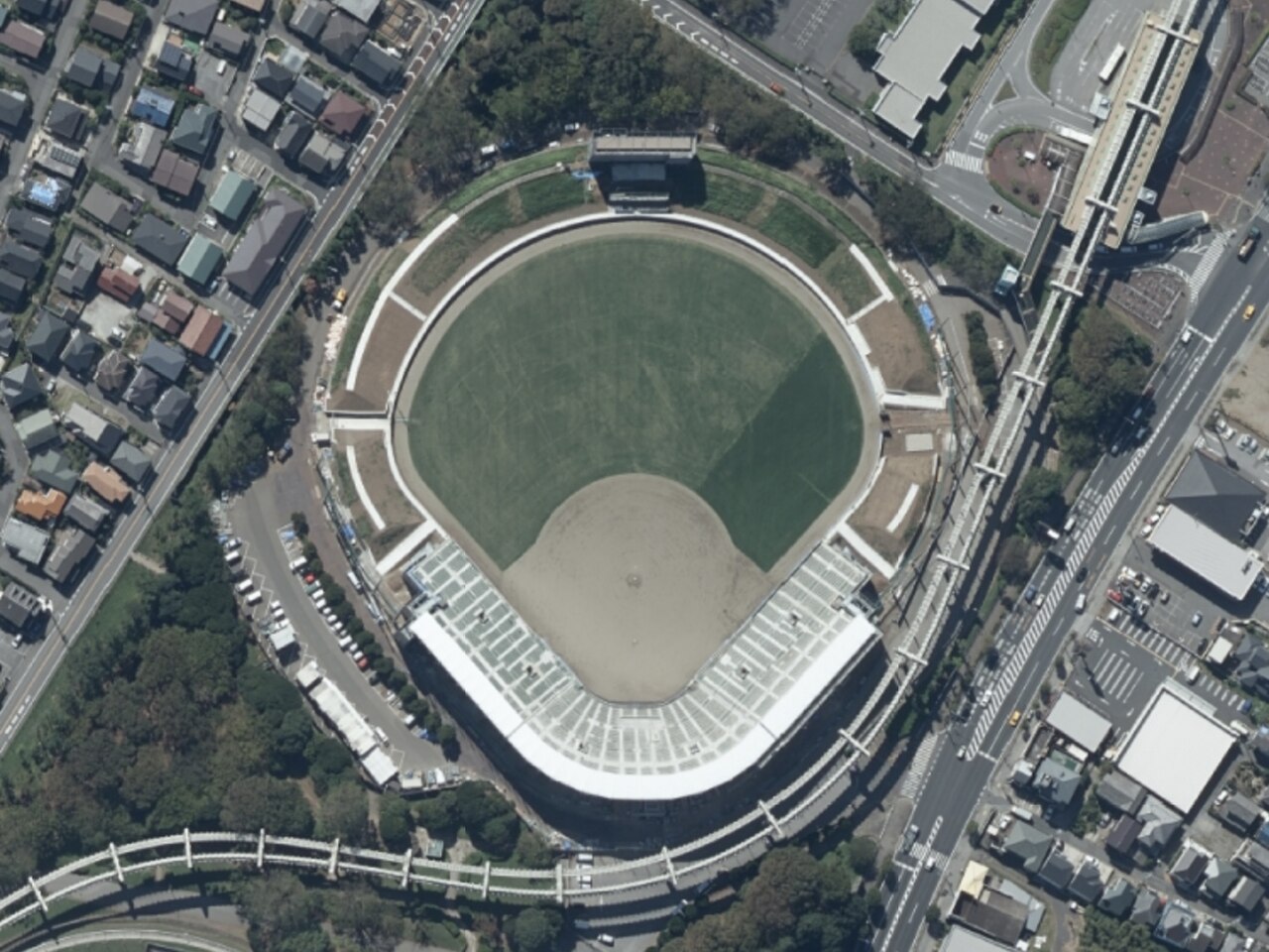
日本語: 千葉県千葉市稲毛区天台町にある、千葉県野球場の航空写真。上方が南。
|
| Date | |
| Source | 地理院地図 (https://maps.gsi.go.jp) |
| Author | 国土地理院 (Geospatial Information Authority of Japan) |
Licensing[edit]

|
The copyright holder of this file, Geospatial Information Authority of Japan, allows anyone to use it for any purpose, provided that the copyright holder is properly attributed. Redistribution, derivative work, commercial use, and all other use is permitted. |
Attribution:
Copyright © Geospatial Information Authority of Japan
|
 |
This image is copyrighted by Geospatial Information Authority of Japan. For terms of use, see GSI Contents Terms of Use (in Japanese) and "2. Items other than basic survey results that can be used only with a mention of the source (基本測量成果以外で出典の記載のみで利用可能なもの)" in GSI Tiles (in Japanese). When you display this image on an article, please include "Geospatial Information Authority of Japan" or "GSI Tiles" in the description.
|
File history
Click on a date/time to view the file as it appeared at that time.
| Date/Time | Thumbnail | Dimensions | User | Comment | |
|---|---|---|---|---|---|
| current | 10:04, 29 May 2023 | | 1,500 × 1,125 (493 KB) | Uraniwa (talk | contribs) | Uploaded a work by 国土地理院 (Geospatial Information Authority of Japan) from 地理院地図 (https://maps.gsi.go.jp) with UploadWizard |
You cannot overwrite this file.
File usage on Commons
The following page uses this file:
File usage on other wikis
The following other wikis use this file:
- Usage on ja.wikipedia.org