File:ChelasCP.png
Jump to navigation
Jump to search

Size of this preview: 600 × 600 pixels. Other resolutions: 240 × 240 pixels | 480 × 480 pixels | 702 × 702 pixels.
Original file (702 × 702 pixels, file size: 162 KB, MIME type: image/png)
Captions
Captions
Add a one-line explanation of what this file represents
Summary[edit]
| Description |
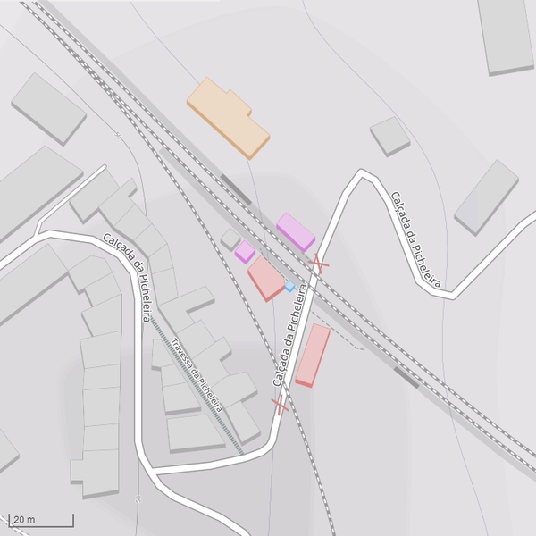
Português: Situação da Estação de Chelas e edifícios anexos (Lisboa):
|
| Date | between 1990 and 2020 |
| Source |
|
| Author |
|
| Permission (Reusing this file) |
See below. |
| 1st uploaded as the | 90,093,741th file in Wikimedia Commons |
| Object location | | View this and other nearby images on: OpenStreetMap |
|---|
Licensing[edit]
| Description |
This map was created from OpenStreetMap project data, collected by the community. This map may be incomplete, and may contain errors. Don't rely solely on it for navigation. |
|||
| Date | (see file history) | |||
| Source | openstreetmap.org | |||
| Creator |
OpenStreetMap contributors |
|||
| Permission (Reusing this file) |
OpenStreetMap data is available under the Open Database License (details). Map tiles are licensed under the Creative Commons Attribution-ShareAlike 2.0 license (CC-BY-SA 2.0).
This file is licensed under the Creative Commons Attribution-Share Alike 2.0 Generic license.
|
|||
| Georeferencing | If inappropriate please set warp_status = skip to hide. |
File history
Click on a date/time to view the file as it appeared at that time.
| Date/Time | Thumbnail | Dimensions | User | Comment | |
|---|---|---|---|---|---|
| current | 01:55, 14 January 2023 | | 702 × 702 (162 KB) | Tuvalkin (talk | contribs) | wrong color corrected; +shelters |
| 01:42, 14 January 2023 |  | 702 × 702 (161 KB) | Tuvalkin (talk | contribs) | +1 ed. roxo; +plataformas | |
| 00:52, 14 January 2023 |  | 702 × 702 (149 KB) | Tuvalkin (talk | contribs) | corr. (laranja) | |
| 00:27, 14 January 2023 |  | 702 × 702 (149 KB) | Tuvalkin (talk | contribs) | +edifício demolido entre 1989 e 2009 (a roxo) | |
| 20:09, 13 January 2023 |  | 702 × 702 (149 KB) | Tuvalkin (talk | contribs) | == {{int:filedesc}} == {{Information | description = {{pt|1= Situação da Estação de Chelas e edifícios anexos (Lisboa) {{color|#ADADAD|▬}} - edifícios mantidos {{color|#70B7EB|▬}} - edifícios novos {{color|#D68484|▬}} - edifícios demolidos {{color|#D68484|×}} - passagem de nível eliminada }} | source = * https://www.openstreetmap.org/#map=18/38.73854/-9.11849&layers=C * {{en|additional info gleaned from various sources, none copied ''verbatim''}} | date = {{between|2005|2020}} | author = * C... |
You cannot overwrite this file.
File usage on Commons
The following 3 pages use this file:
File usage on other wikis
The following other wikis use this file:
- Usage on pt.wikipedia.org