File:Charles Evans Hughes residence - plaque.jpg
Jump to navigation
Jump to search

Size of this preview: 800 × 486 pixels. Other resolutions: 320 × 194 pixels | 640 × 389 pixels | 1,024 × 622 pixels | 1,396 × 848 pixels.
Original file (1,396 × 848 pixels, file size: 322 KB, MIME type: image/jpeg)
Captions
Captions
Add a one-line explanation of what this file represents
| Description |
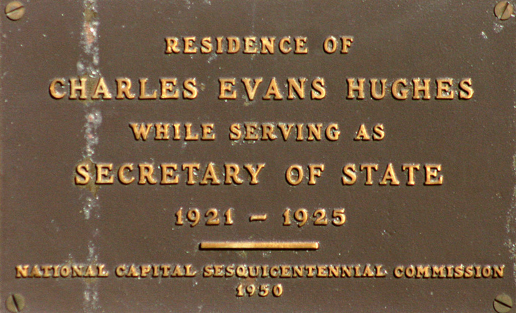
English: A plaque denoting the building located at 1529 18th Street, NW in the Dupont Circle neighborhood of Washington, D.C. was the former residence of United States Secretary of State Charles Evans Hughes from 1921–1925. The five-story, Classical Revival building was constructed in 1903, and currently serves as the Mathematical Association of America (MAA) headquarters. It is a contributing property to the Dupont Circle Historic District, with a 2009 property value of $6,733,700.
|
||
| Date | |||
| Source | flickr | ||
| Author | dbking | ||
| Permission (Reusing this file) |
This file is licensed under the Creative Commons Attribution 2.0 Generic license.
|
| Camera location | | View this and other nearby images on: OpenStreetMap |
|---|
File history
Click on a date/time to view the file as it appeared at that time.
| Date/Time | Thumbnail | Dimensions | User | Comment | |
|---|---|---|---|---|---|
| current | 05:20, 3 August 2009 | | 1,396 × 848 (322 KB) | APK (talk | contribs) | {{Information |Description={{en|A plaque denoting the building located at 1529 18th Street, NW in the Dupont Circle neighborhood of Washington, D.C. was the former residence of United States Secretary of State [[:w:Charles Evans Hughes|Charles Evans Hughe |
You cannot overwrite this file.
File usage on Commons
There are no pages that use this file.