File:Channel Islands viewed from ISS in 2012.JPG
Jump to navigation
Jump to search
Size of this preview: 399 × 600 pixels. Other resolutions: 160 × 240 pixels | 319 × 480 pixels | 511 × 768 pixels | 681 × 1,024 pixels | 1,363 × 2,048 pixels | 2,832 × 4,256 pixels.
Original file (2,832 × 4,256 pixels, file size: 3.78 MB, MIME type: image/jpeg)
Captions
Captions
Add a one-line explanation of what this file represents
Summary[edit]
| Description |
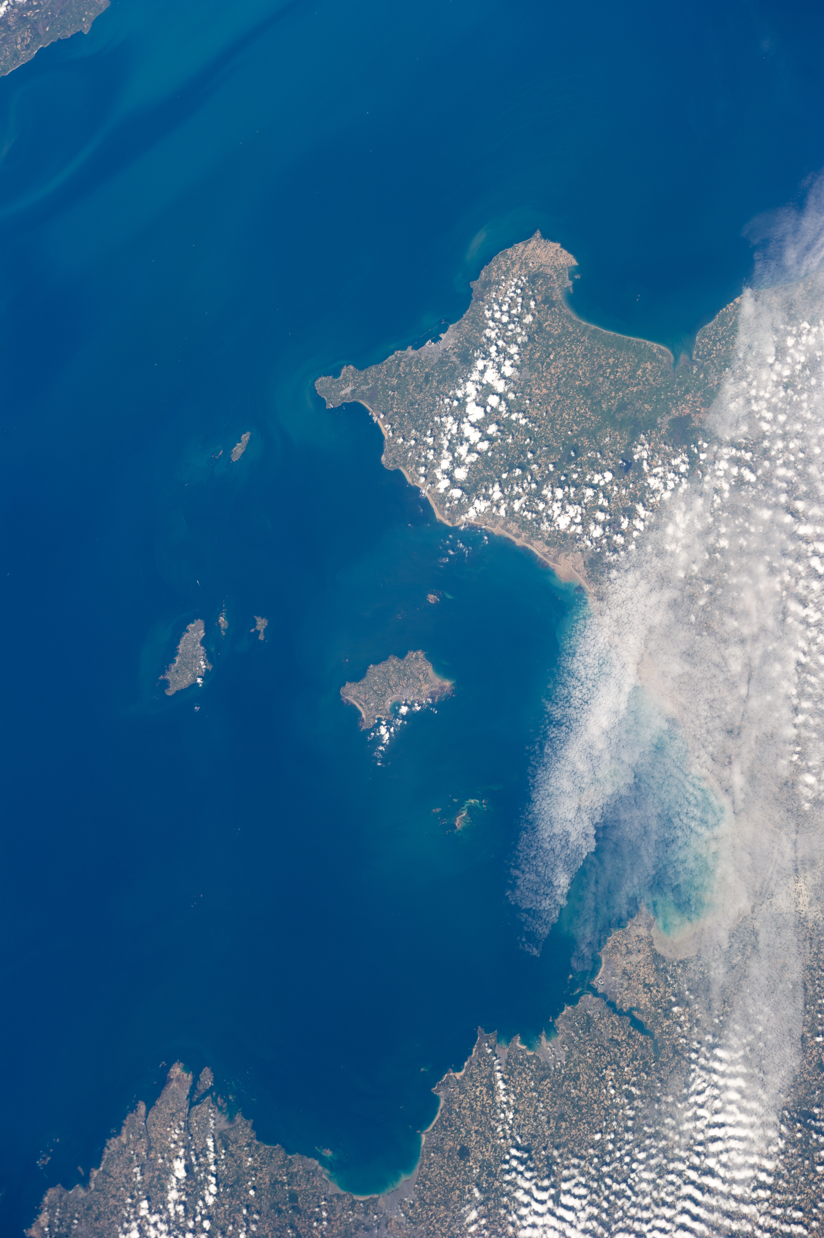
English: The Channel Islands and Normandy viewed from the International Space Station on 19 May 2011. Colour adjusted and rotated left counter clockwise.
|
||||||||||||||||||||||||||||||||||||||||||||||||
| Date | |||||||||||||||||||||||||||||||||||||||||||||||||
| Source | http://eol.jsc.nasa.gov/scripts/sseop/photo.pl?mission=ISS027&roll=E&frame=034504 | ||||||||||||||||||||||||||||||||||||||||||||||||
| Author | NASA | ||||||||||||||||||||||||||||||||||||||||||||||||
| Other versions |
|
||||||||||||||||||||||||||||||||||||||||||||||||

Licensing[edit]
| This file is in the public domain in the United States because it was solely created by NASA. NASA copyright policy states that "NASA material is not protected by copyright unless noted". (See Template:PD-USGov, NASA copyright policy page or JPL Image Use Policy.) | ||
 |
Warnings:
|
File history
Click on a date/time to view the file as it appeared at that time.
| Date/Time | Thumbnail | Dimensions | User | Comment | |
|---|---|---|---|---|---|
| current | 11:40, 7 April 2013 | | 2,832 × 4,256 (3.78 MB) | Danrok (talk | contribs) | User created page with UploadWizard |
You cannot overwrite this file.
File usage on Commons
The following page uses this file: