File:Chōsen oyobi Bokkai kinbō - karisei Tōa yochizu. LOC 2006629017.jpg
Jump to navigation
Jump to search

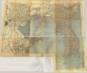
Size of this preview: 706 × 600 pixels. Other resolutions: 283 × 240 pixels | 565 × 480 pixels | 905 × 768 pixels | 1,206 × 1,024 pixels | 2,412 × 2,048 pixels | 17,450 × 14,818 pixels.
Original file (17,450 × 14,818 pixels, file size: 36.07 MB, MIME type: image/jpeg)
Captions
Captions
Add a one-line explanation of what this file represents
Summary[edit]
| Warning | The original file is very high-resolution. It might not load properly or could cause your browser to freeze when opened at full size. |
|---|
| Description |
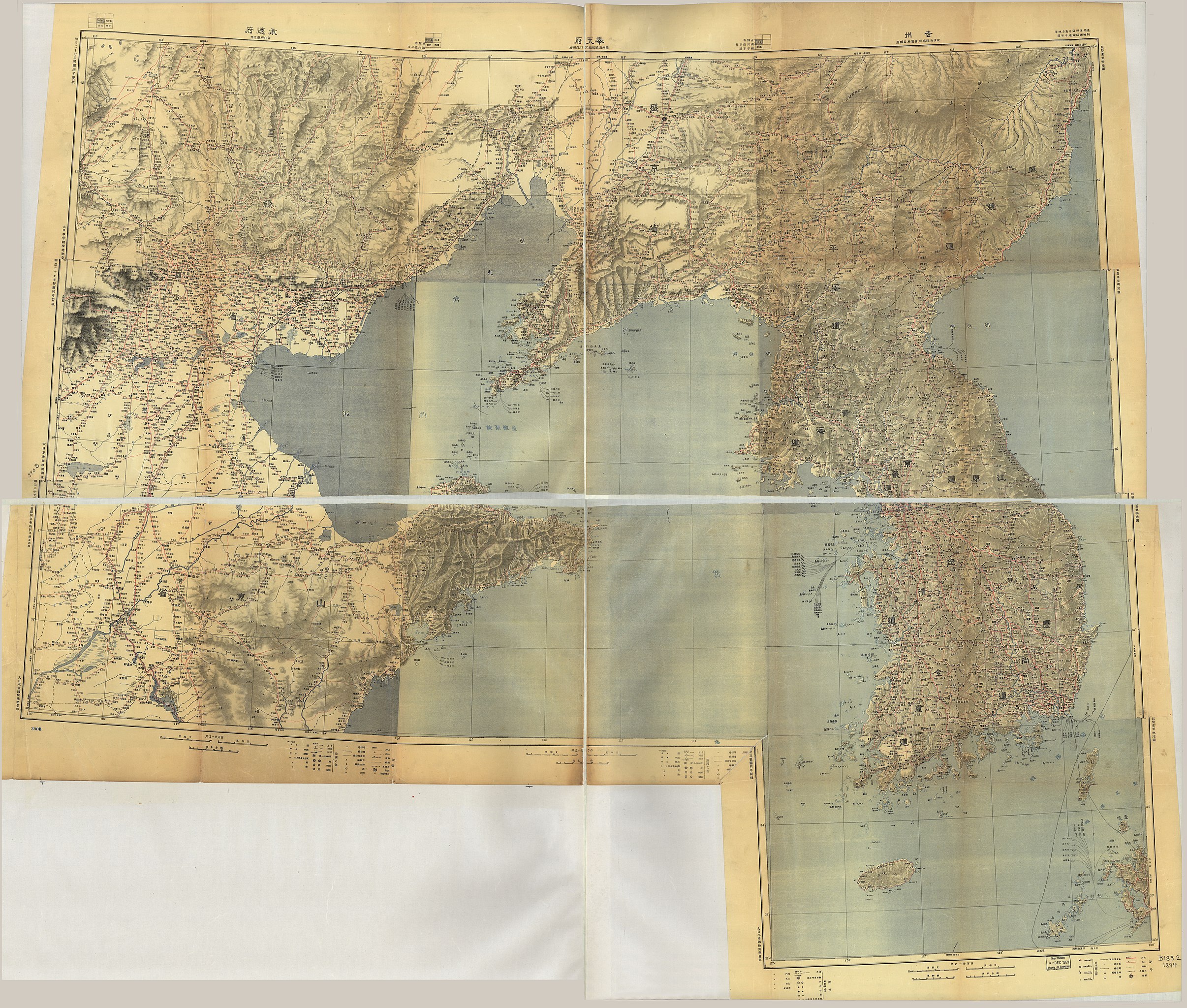
English: Relief shown by shading. Title from verso of map. Available also through the Library of Congress Web site as a raster image. LC set 2 has 10 separate maps (38 x 52 cm. folded to 19 x 13 cm.) placed in envelope. LC set 2 has "[WDC?] 399179" pencilled. A hand-made map in 2 sheets (top half, 63 x 135 cm.; bottom half, 62 x 135 cm.), made up with 10 maps of 假製東亞輿地圖 pasted together; top row, right to left [nos. 1-3], 2nd row [nos. 4-6], 3rd row [nos. 7-9], 4th row right [no. 10]. [1] 吉州 -- [2] 奉天府 -- [3] 承德府 -- [4] 漢城 -- [5] 芝罘 -- [6] 北京 -- [7] 釜山 -- [8] 膠州 -- [9] 濟南府 -- [10] 長崎. LC set 2 has "屯田步兵第三大隊・第貮中隊" written. DLC A hand-made map in 2 sheets (top half, 63 x 135 cm.; bottom half, 62 x 135 cm.), made up with 10 maps of 假製東亞輿地圖 pasted together; top row, right to left [nos. 1-3], 2nd row [nos. 4-6], 3rd row [nos. 7-9], 4th row right [no. 10]. |
||
| Title | Chōsen oyobi Bokkai kinbō : karisei Tōa yochizu. | ||
| Shelf ID | G7900 s1000 .J3 | ||
| Date | |||
| Source | https://www.loc.gov/item/2006629017/ | ||
| Author | Japan. Rikuchi Sokuryōbu. | ||
| Permission (Reusing this file) |
|
||
| Location | Korea | ||
| Part of | American Memory · General Maps · Catalog · Geography And Map Division | ||
| Subject | Maps · Korea |

Licensing[edit]
|
This is a faithful photographic reproduction of a two-dimensional, public domain work of art. The work of art itself is in the public domain for the following reason:
The official position taken by the Wikimedia Foundation is that "faithful reproductions of two-dimensional public domain works of art are public domain".
This photographic reproduction is therefore also considered to be in the public domain in the United States. In other jurisdictions, re-use of this content may be restricted; see Reuse of PD-Art photographs for details. | ||||
File history
Click on a date/time to view the file as it appeared at that time.
| Date/Time | Thumbnail | Dimensions | User | Comment | |
|---|---|---|---|---|---|
| current | 19:49, 23 May 2018 | | 17,450 × 14,818 (36.07 MB) | Fæ (talk | contribs) | LOC Maps https://www.loc.gov/item/2006629017/ #13886 |
You cannot overwrite this file.
File usage on Commons
There are no pages that use this file.