File:Cayman Islands Map.png
Jump to navigation
Jump to search
Size of this preview: 800 × 397 pixels. Other resolutions: 320 × 159 pixels | 640 × 317 pixels | 1,024 × 508 pixels | 1,280 × 635 pixels | 2,678 × 1,328 pixels.
Original file (2,678 × 1,328 pixels, file size: 200 KB, MIME type: image/png)
Captions
Captions
Add a one-line explanation of what this file represents

|
File:Cayman Islands Map.svg is a vector version of this file. It should be used in place of this PNG file when not inferior.
File:Cayman Islands Map.png → File:Cayman Islands Map.svg
For more information, see Help:SVG. |
 |
| Description |
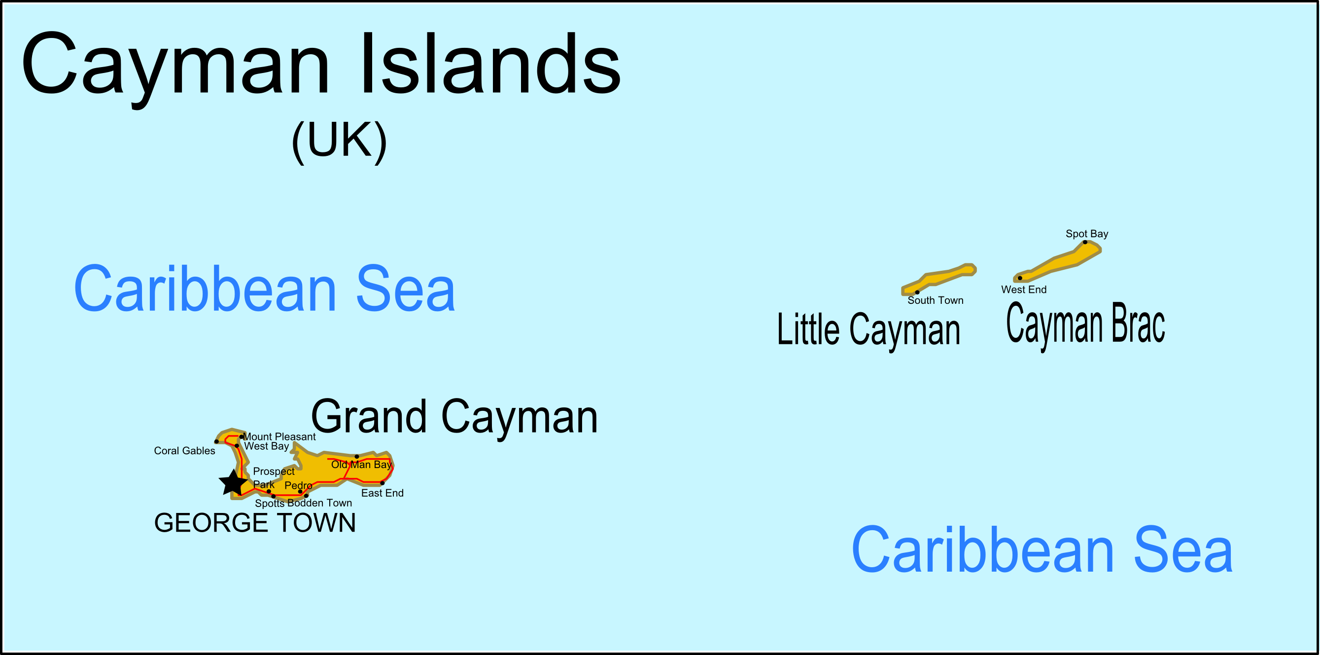
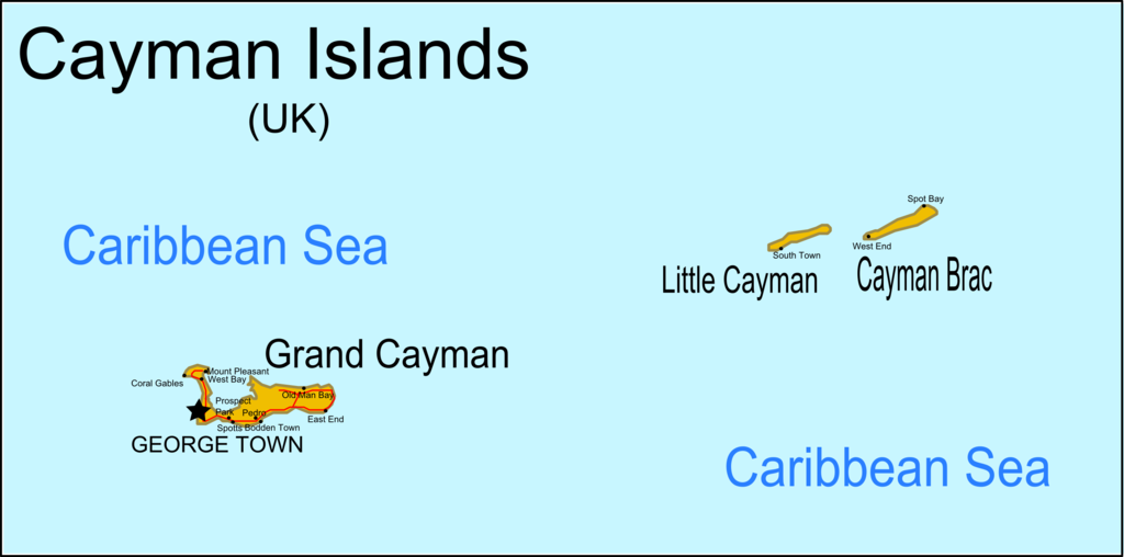
English: Map of the Cayman Islands. Information from CIA MAP, Yahoo Map Only for use while Cayman Islands Map.svg cannot render here. |
| Date | original unknown |
| Source | outline from PlaniGlobe |
| Author | Planiglobe (outline), RaviC |
Licensing[edit]
This file is licensed under the Creative Commons Attribution 2.5 Generic license.
- You are free:
- to share – to copy, distribute and transmit the work
- to remix – to adapt the work
- Under the following conditions:
- attribution – You must give appropriate credit, provide a link to the license, and indicate if changes were made. You may do so in any reasonable manner, but not in any way that suggests the licensor endorses you or your use.
File history
Click on a date/time to view the file as it appeared at that time.
| Date/Time | Thumbnail | Dimensions | User | Comment | |
|---|---|---|---|---|---|
| current | 19:43, 6 April 2009 | | 2,678 × 1,328 (200 KB) | RaviC (talk | contribs) | {{Information |Description={{en|1=Map of the Cayman Islands.}} Information from [http://upload.wikimedia.org/wikipedia/commons/2/20/Cayman_Islands-CIA_WFB_Map.png CIA MAP], [http://www.mbs.maine.edu/~strong_robert/Cayman%20Islands%20trip/Cayman%20Islands% |
You cannot overwrite this file.
File usage on Commons
There are no pages that use this file.
File usage on other wikis
The following other wikis use this file:
- Usage on en.wikipedia.org