File:Catfish Pond Control Structure.jpg
Jump to navigation
Jump to search

Size of this preview: 800 × 533 pixels. Other resolutions: 320 × 213 pixels | 640 × 426 pixels | 1,024 × 682 pixels | 1,500 × 999 pixels.
Original file (1,500 × 999 pixels, file size: 607 KB, MIME type: image/jpeg)
Captions
Captions
Add a one-line explanation of what this file represents
| Description |
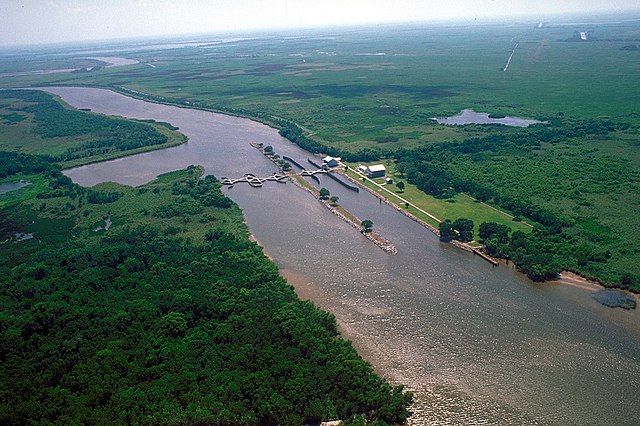
English: Catfish Point Control Structure, at the outlet of Grand Lake into the Mermentau River, which flows into Vermilion Bay in the Gulf of Mexico. The lock is located in at the east end of Cameron Parish, Louisiana, USA. This lock is a salt water intrusion barrier to prevent the waters from the Gulf of Mexico from intruding into Grand Lake and the freshwater bayous and rivers. |
|||
| Date | ||||
| Source |
U.S. Army Corps of Engineers Digital Visual Library Image page Image description page Digital Visual Library home page |
|||
| Author | Arthur Belala, U.S. Army Corps of Engineers | |||
| Permission (Reusing this file) |
|
|||
| Location | Grand Lake, Louisiana, USA |
| Camera location | | View this and other nearby images on: OpenStreetMap |
|---|
File history
Click on a date/time to view the file as it appeared at that time.
| Date/Time | Thumbnail | Dimensions | User | Comment | |
|---|---|---|---|---|---|
| current | 04:42, 5 April 2007 | | 1,500 × 999 (607 KB) | DanMS (talk | contribs) | {{Information | Description = {{en|Catfish Point Control Structure, Mermentau River, at Grand Lake, Louisiana, USA. This lock is a salt water intrusion barrier to prevent the waters from the Gulf of Mexico from intruding into the freshwater bayous and |
You cannot overwrite this file.
File usage on Commons
There are no pages that use this file.
File usage on other wikis
The following other wikis use this file:
- Usage on de.wikipedia.org
- Usage on en.wikipedia.org
- Usage on id.wikipedia.org