File:Cartouche in a Black Sea map by Dunn.jpg
Jump to navigation
Jump to search
Size of this preview: 539 × 600 pixels. Other resolutions: 216 × 240 pixels | 431 × 480 pixels | 690 × 768 pixels | 920 × 1,024 pixels | 2,175 × 2,421 pixels.
Original file (2,175 × 2,421 pixels, file size: 1,005 KB, MIME type: image/jpeg)
Captions
Captions
Add a one-line explanation of what this file represents
Summary[edit]
| Warning | The original file is very high-resolution. It might not load properly or could cause your browser to freeze when opened at full size. |
|---|
| Description |
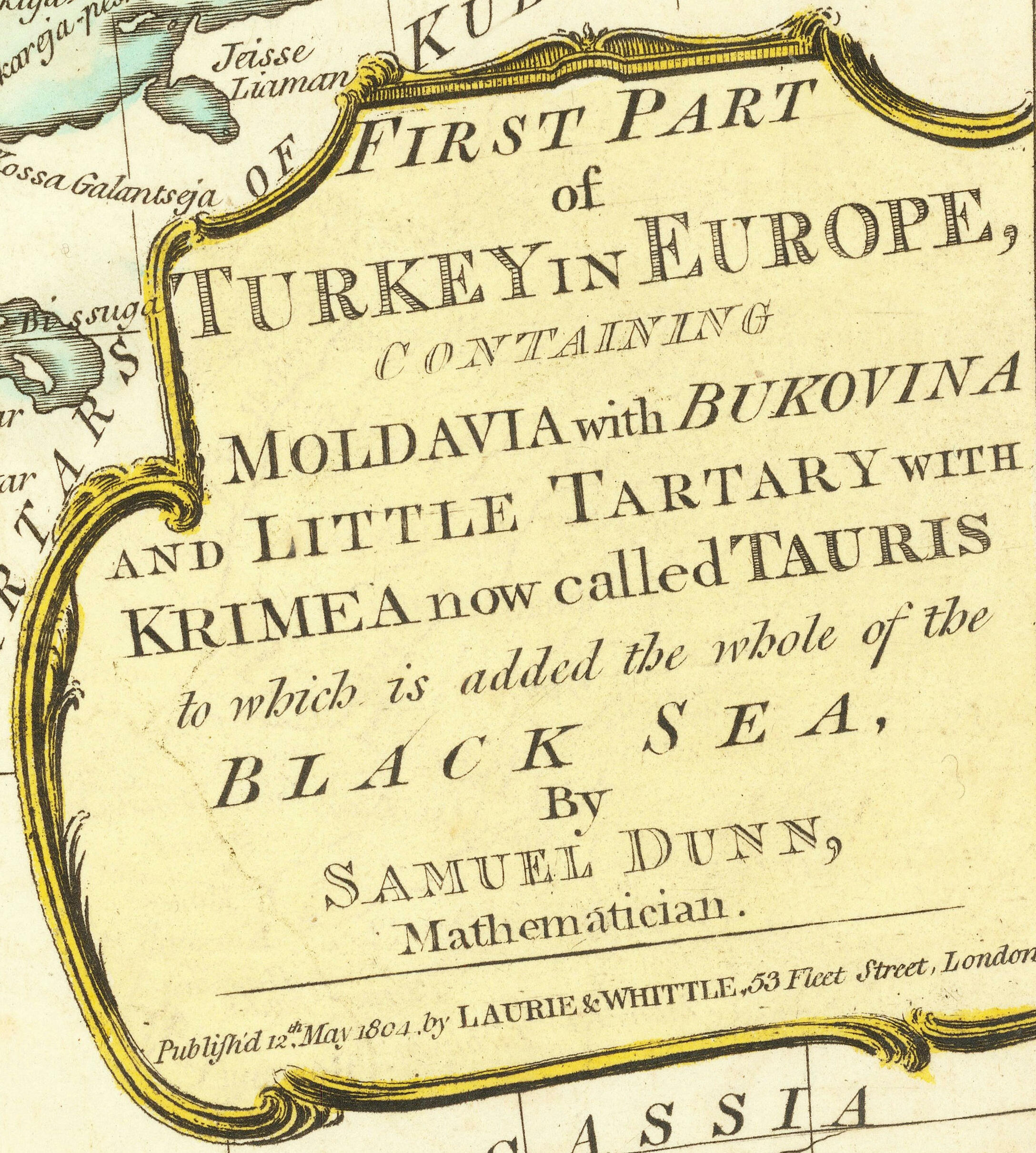
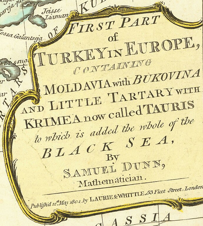
English: Map of the territories of the Ottoman Empire around the Black Sea by Samuel Dunn, published 1804 |
||||||||||||||||
| Date | |||||||||||||||||
| Source | https://www.raremaps.com/gallery/detail/64986/first-part-of-turkey-in-europe-containing-moldovia-and-lit-dunn | ||||||||||||||||
| Author |
|
||||||||||||||||
| Other versions | |||||||||||||||||

Licensing[edit]
|
This work is in the public domain in its country of origin and other countries and areas where the copyright term is the author's life plus 70 years or fewer. This work is in the public domain in the United States because it was published (or registered with the U.S. Copyright Office) before January 1, 1929. | |
| This file has been identified as being free of known restrictions under copyright law, including all related and neighboring rights. | |
File history
Click on a date/time to view the file as it appeared at that time.
| Date/Time | Thumbnail | Dimensions | User | Comment | |
|---|---|---|---|---|---|
| current | 17:07, 17 December 2022 | | 2,175 × 2,421 (1,005 KB) | Enyavar (talk | contribs) | File:Map of the territories of the Ottoman Empire around the Black Sea by Samuel Dunn, published 1804.jpg cropped 82 % horizontally, 74 % vertically using CropTool with precise mode. |
You cannot overwrite this file.
File usage on Commons
The following page uses this file: