File:Carthage, Tunisia EO-1.jpg
Jump to navigation
Jump to search
Size of this preview: 600 × 600 pixels. Other resolutions: 240 × 240 pixels | 480 × 480 pixels | 768 × 768 pixels | 1,024 × 1,024 pixels | 2,048 × 2,048 pixels | 3,000 × 3,000 pixels.
Original file (3,000 × 3,000 pixels, file size: 3.37 MB, MIME type: image/jpeg)
Captions
Captions
Add a one-line explanation of what this file represents
Summary[edit]
| Description |
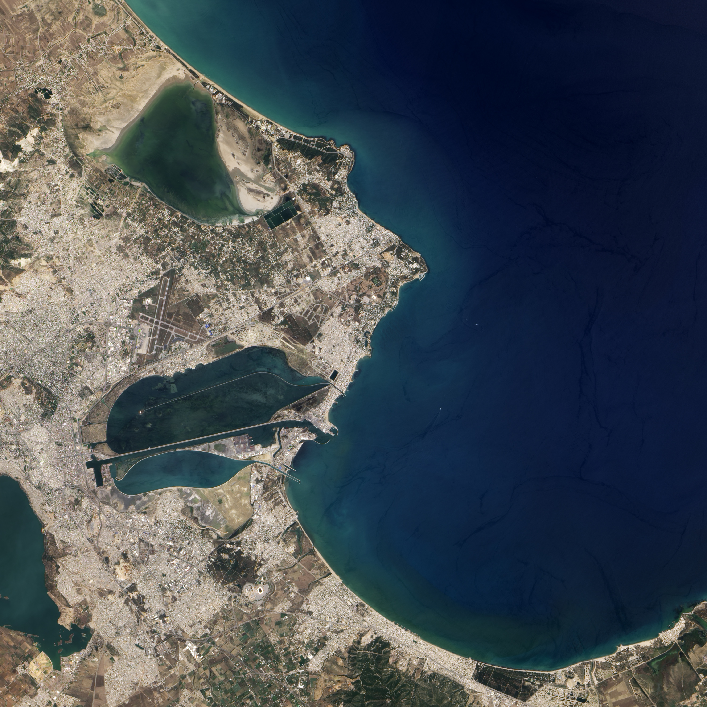
English: Natural-colour image of Carthage on June 24, 2004. In the east, Carthage narrows to a point that stretches into the Gulf of Tunis. From that point, skinny strips of land extend toward the north-west and south-west, both strips enclosing water bodies. North of Carthage is Sebkhet Arina, a shallow evaporative lake. Rocky outcrops connected by sand separate this shallow lake from the Gulf of Tunis. South of Carthage is Lake Tunis, a water body actively modified and maintained by humans over thousands of years. |
| Date | |
| Source | NASA Earth Observatory |
| Author | Jesse Allen |
Image captured by the Advanced Land Imager (ALI) on NASA’s Earth Observing-1 (EO-1) satellite. EO-1 ALI data provided courtesy of the NASA EO-1 team.
Licensing[edit]
| This file is in the public domain in the United States because it was solely created by NASA. NASA copyright policy states that "NASA material is not protected by copyright unless noted". (See Template:PD-USGov, NASA copyright policy page or JPL Image Use Policy.) | ||
 |
Warnings:
|
| Annotations | This image is annotated: View the annotations at Commons |
File history
Click on a date/time to view the file as it appeared at that time.
| Date/Time | Thumbnail | Dimensions | User | Comment | |
|---|---|---|---|---|---|
| current | 12:40, 16 August 2010 | | 3,000 × 3,000 (3.37 MB) | Originalwana (talk | contribs) | {{Information |Description={{en|1=Natural-colour image of Carthage on June 24, 2004. In the east, Carthage narrows to a point that stretches into the Gulf of Tunis. From that point, skinny strips of land extend toward the north |
You cannot overwrite this file.
File usage on Commons
The following page uses this file:
File usage on other wikis
The following other wikis use this file: