File:Carte generale des paroisses et missions etablies des deux cotes du fleuve St Laurent - 04.jpg
Jump to navigation
Jump to search

Size of this preview: 800 × 297 pixels. Other resolutions: 320 × 119 pixels | 640 × 238 pixels | 1,516 × 563 pixels.
Original file (1,516 × 563 pixels, file size: 213 KB, MIME type: image/jpeg)
Captions
Captions
Add a one-line explanation of what this file represents
Summary[edit]
| Description |
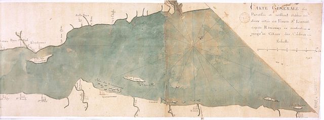
Français : Carte générale des paroisses et missions établies des deux côtés du fleuve St Laurent depuis Rimousky en montant jusqu'au Côteau des Cèdres |
| Date | between 1740 and 1749 |
| Source | http://gallica.bnf.fr/ark:/12148/btv1b6700332c |
| Author | gallica.bnf.fr / Bibliothèque nationale de France |
Licensing[edit]
|
This work is in the public domain in its country of origin and other countries and areas where the copyright term is the author's life plus 70 years or fewer. This work is in the public domain in the United States because it was published (or registered with the U.S. Copyright Office) before January 1, 1929. | |
| This file has been identified as being free of known restrictions under copyright law, including all related and neighboring rights. | |
File history
Click on a date/time to view the file as it appeared at that time.
| Date/Time | Thumbnail | Dimensions | User | Comment | |
|---|---|---|---|---|---|
| current | 16:16, 7 November 2015 | 1,516 × 563 (213 KB) | Jeangagnon (talk | contribs) | User created page with UploadWizard |
You cannot overwrite this file.
File usage on Commons
There are no pages that use this file.