File:Carte de la France - Dinan NE ; feuille N°60 - France. Service géographique de l'Armée - btv1b10567915c.jpg
Jump to navigation
Jump to search

Size of this preview: 800 × 550 pixels. Other resolutions: 320 × 220 pixels | 640 × 440 pixels | 1,024 × 704 pixels | 1,280 × 880 pixels | 2,560 × 1,760 pixels | 5,732 × 3,941 pixels.
Original file (5,732 × 3,941 pixels, file size: 3.45 MB, MIME type: image/jpeg)
Captions
Captions
Add a one-line explanation of what this file represents
Summary[edit]
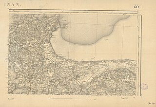
| Carte de la France : Dinan NE ; feuille N°60 / France. Service géographique de l'Armée
( |
|||||||||||||||||||||||||||
|---|---|---|---|---|---|---|---|---|---|---|---|---|---|---|---|---|---|---|---|---|---|---|---|---|---|---|---|
| Author |
France. Service géographique de l'Armée. Fonction indéterminée |
||||||||||||||||||||||||||
| Title |
Carte de la France : Dinan NE ; feuille N°60 / France. Service géographique de l'Armée |
||||||||||||||||||||||||||
| Description |
Français : Sujet : Dinan (Côtes-d'Armor ; région) -- 19e siècle -- Cartes
Côtes-d'Armor Dinan Appartient à l’ensemble documentaire : PrnS001 Langue : sans contenu linguistique |
||||||||||||||||||||||||||
| Date | 1889 | ||||||||||||||||||||||||||
| Collection |
|
||||||||||||||||||||||||||
| References |
Français : Notice du catalogue : http://catalogue.bnf.fr/ark:/12148/cb44932721k |
||||||||||||||||||||||||||
| Source/Photographer |
Français : Archives et bibliothèques Pau Béarn Pyrénées, 220170 (60)
Bibliothèque nationale de France |
||||||||||||||||||||||||||
| Permission (Reusing this file) |
|
||||||||||||||||||||||||||

File history
Click on a date/time to view the file as it appeared at that time.
| Date/Time | Thumbnail | Dimensions | User | Comment | |
|---|---|---|---|---|---|
| current | 15:38, 20 July 2022 | | 5,732 × 3,941 (3.45 MB) | Gzen92Bot (talk | contribs) | Gallica btv1b10567915c |
You cannot overwrite this file.
File usage on Commons
The following page uses this file: