File:Carte de la Barbarie, de la Nigritie, et de la Guinée LOC 2005625339.jpg
Jump to navigation
Jump to search

Size of this preview: 800 × 592 pixels. Other resolutions: 320 × 237 pixels | 640 × 473 pixels | 1,024 × 757 pixels | 1,280 × 947 pixels | 2,560 × 1,893 pixels | 8,541 × 6,316 pixels.
Original file (8,541 × 6,316 pixels, file size: 6.65 MB, MIME type: image/jpeg)
Captions
Captions
Add a one-line explanation of what this file represents
Summary[edit]
| Description |
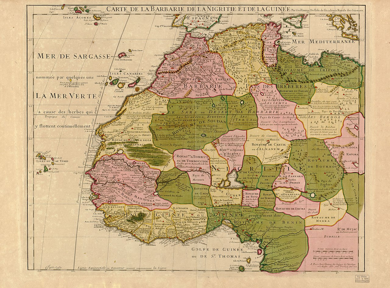
English: Relief shown pictorially. "Avec privilege, Aout 1707." "The words 'premier geographe du Roi' added in the title ... [indicate] that [a map] could not have been issued before 1718 when [De l'Isle] was appointed to that office"--Tooley, R.V. Guide to maps of Africa, p. 68. Prime meridian: Ferro. Similar to Norwich, O.I. Maps of Africa, 317 Available also through the Library of Congress Web site as a raster image. |
|||||||||||||||||||||||
| Title | Carte de la Barbarie, de la Nigritie, et de la Guinée | |||||||||||||||||||||||
| Shelf ID | G8220 1707 .L5 | |||||||||||||||||||||||
| Date | ||||||||||||||||||||||||
| Source | https://www.loc.gov/item/2005625339/ | |||||||||||||||||||||||
| Author |
|
|||||||||||||||||||||||
| Permission (Reusing this file) |
|
|||||||||||||||||||||||
| Other versions |
|
|||||||||||||||||||||||
| Location | Africa, North · North Africa · West Africa · Africa, West | |||||||||||||||||||||||
| Part of | American Memory · General Maps · Catalog · Geography And Map Division | |||||||||||||||||||||||
| Subject | Maps · Africa, North · Early Works To 1800 · Africa, West | |||||||||||||||||||||||


Licensing[edit]
|
This is a faithful photographic reproduction of a two-dimensional, public domain work of art. The work of art itself is in the public domain for the following reason:
The official position taken by the Wikimedia Foundation is that "faithful reproductions of two-dimensional public domain works of art are public domain".
This photographic reproduction is therefore also considered to be in the public domain in the United States. In other jurisdictions, re-use of this content may be restricted; see Reuse of PD-Art photographs for details. | ||||
File history
Click on a date/time to view the file as it appeared at that time.
| Date/Time | Thumbnail | Dimensions | User | Comment | |
|---|---|---|---|---|---|
| current | 09:08, 11 June 2018 | | 8,541 × 6,316 (6.65 MB) | Fæ (talk | contribs) | LOC Maps https://www.loc.gov/item/2005625339/ #11706 |
You cannot overwrite this file.
File usage on Commons
The following page uses this file: