File:Carte Topographique de l'Ile Saint Eustache Samuel Fahlberg 1830.jpg
Original file (5,458 × 4,540 pixels, file size: 18.71 MB, MIME type: image/jpeg)
Captions
Captions
Summary[edit]
| Description |
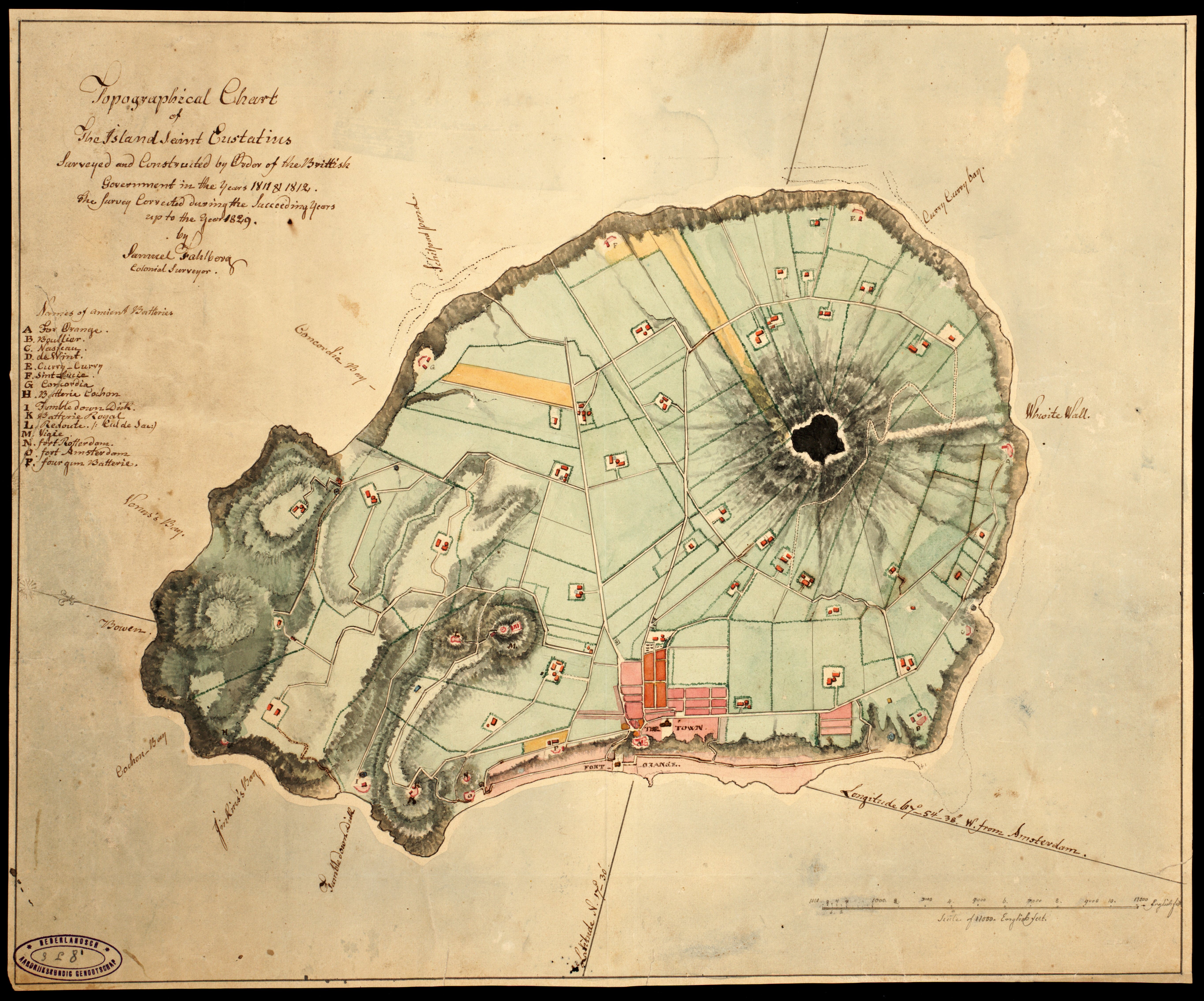
English: Topographic Map of the Island Sint Eustatius Dutch Caribbean by Samuel Fahlberg (Sweden 1758 - Sint Eustatius 1834) in 1830. Name of the map: Carte Topographique de l'Ille Saint Eustache Relevée & Corrigée par Samuel Fahlberg 1830. Language French |
| Date | |
| Source | https://hdl.handle.net/11245/3.24 |
| Author | Samuel Fahlberg |
Licensing[edit]
|
This is a faithful photographic reproduction of a two-dimensional, public domain work of art. The work of art itself is in the public domain for the following reason:
The official position taken by the Wikimedia Foundation is that "faithful reproductions of two-dimensional public domain works of art are public domain".
This photographic reproduction is therefore also considered to be in the public domain in the United States. In other jurisdictions, re-use of this content may be restricted; see Reuse of PD-Art photographs for details. | ||||
File history
Click on a date/time to view the file as it appeared at that time.
| Date/Time | Thumbnail | Dimensions | User | Comment | |
|---|---|---|---|---|---|
| current | 09:52, 10 January 2022 | | 5,458 × 4,540 (18.71 MB) | Carib93 (talk | contribs) | Official record |
| 06:57, 10 January 2022 |  | 4,583 × 3,255 (3.39 MB) | Carib93 (talk | contribs) | Uploaded a work by Samuel Fahlberg from https://www.statiagovernment.com/binaries/content/gallery/sint-eustatius-en/content-afbeeldingen/images-for-slideshow/history/old-maps/fahlberg-1830.jpg?download with UploadWizard |
You cannot overwrite this file.
File usage on Commons
There are no pages that use this file.
File usage on other wikis
The following other wikis use this file:
- Usage on nl.wikipedia.org
- Usage on www.wikidata.org