File:Carte Politique du Canada.svg
Jump to navigation
Jump to search

Size of this PNG preview of this SVG file: 736 × 599 pixels. Other resolutions: 295 × 240 pixels | 590 × 480 pixels | 943 × 768 pixels | 1,258 × 1,024 pixels | 2,516 × 2,048 pixels | 1,130 × 920 pixels.
Original file (SVG file, nominally 1,130 × 920 pixels, file size: 218 KB)
Captions
Captions
Add a one-line explanation of what this file represents
Summary[edit]
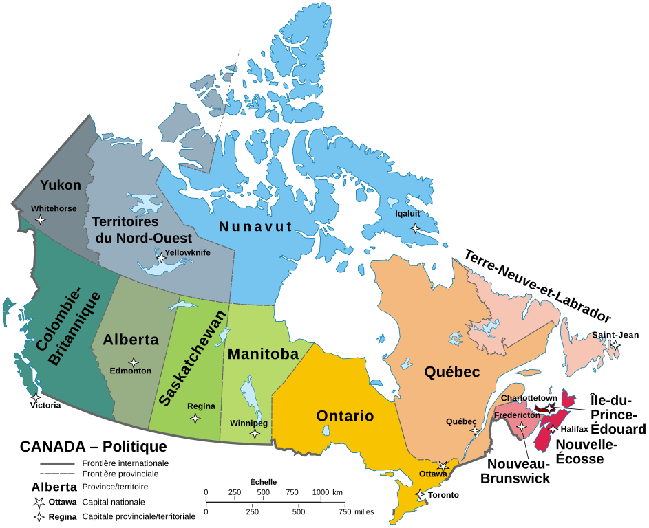
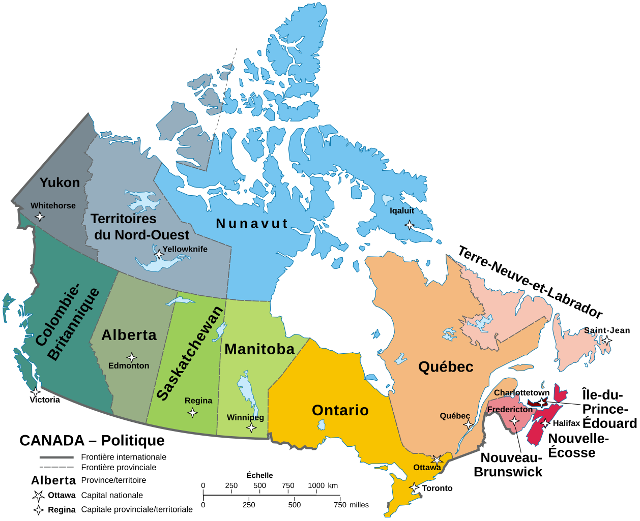
| Description | Une carte du Canada avec ses Provinces and territoires | ||
| Date | |||
| Source | Political map of Canada.svg | ||
| Author | Hogweard | ||
| Permission (Reusing this file) |
|
||
| Other versions | Political map of Canada.svg |
File history
Click on a date/time to view the file as it appeared at that time.
| Date/Time | Thumbnail | Dimensions | User | Comment | |
|---|---|---|---|---|---|
| current | 11:47, 22 September 2023 | | 1,130 × 920 (218 KB) | Lalpino (talk | contribs) | File uploaded using svgtranslate tool (https://svgtranslate.toolforge.org/). Added translation for ca. |
| 11:39, 19 October 2020 |  | 1,130 × 920 (158 KB) | Hogweard (talk | contribs) | J'ai réparé les étiquettes pour Terre-Neuve et St_Jean, j'espère | |
| 08:52, 18 October 2020 |  | 1,130 × 920 (158 KB) | Hogweard (talk | contribs) | == {{int:filedesc}} == {{Information |description=Une carte du Canada avec ses Provinces and territoires |date=2020-10-18 |source={{f|Political map of Canada.svg}} |author={{u|Hogweard}} |permission={{PD-self}} |other versions={{f|Political map of Canada.svg}} }} Category:SVG maps of Canada Category:French language maps of Canada Category:Political maps of Canada |
You cannot overwrite this file.
File usage on Commons
The following 2 pages use this file: