File:Carte Galette saucisse.png
Jump to navigation
Jump to search

Size of this preview: 707 × 599 pixels. Other resolutions: 283 × 240 pixels | 566 × 480 pixels | 906 × 768 pixels | 1,208 × 1,024 pixels | 2,416 × 2,048 pixels | 3,067 × 2,600 pixels.
Original file (3,067 × 2,600 pixels, file size: 825 KB, MIME type: image/png)
Captions
Captions
Add a one-line explanation of what this file represents
Summary[edit]
| Description |
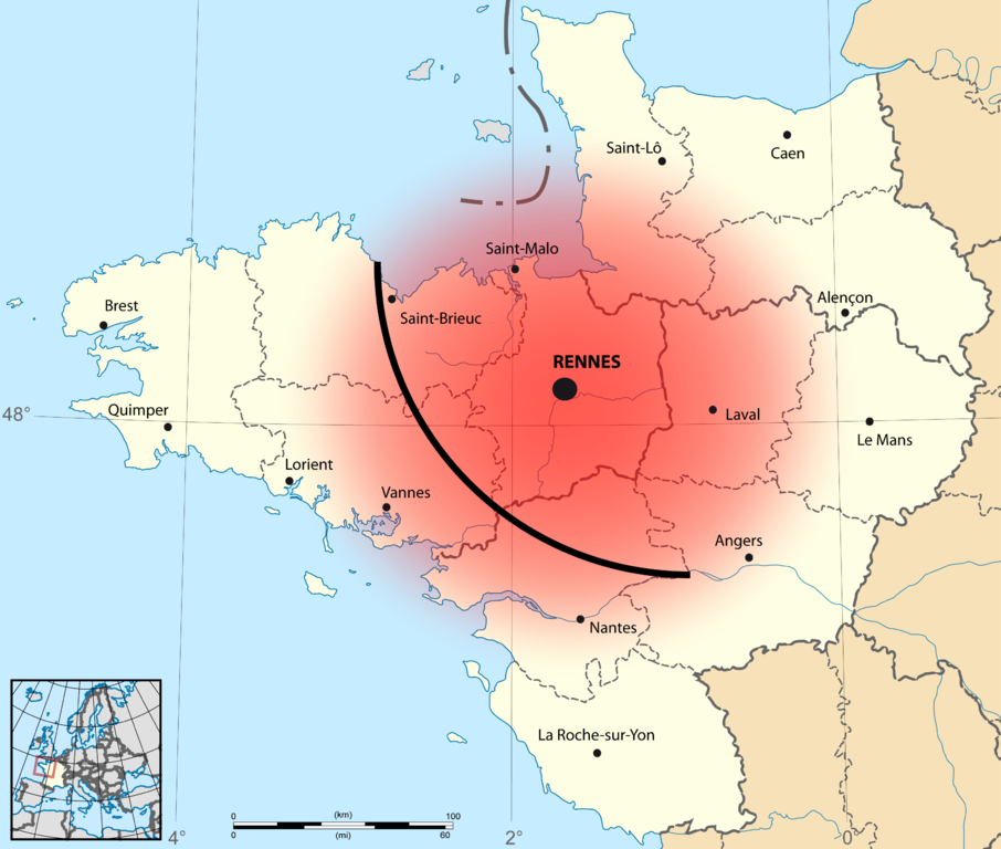
Français : Cartographie présentant la zone de consommation de la galette-saucisse, en Haute-Bretagne.
Le cercle rouge, d'un rayon de 150 kilomètres centré sur Rennes, est issu du livre Galette-saucisse je t'aime ! : le manuel officieux, de Benjamin Keltz, éditions Goater et du Coin de la rue, 2013 La ligne courbe, qui relie Saint-Brieuc et Ancenis en passant par Redon, est issue du livre Atlas de Bretagne / Atlas Breizh de Mikael Bodloré-Penlaez et Divi Kervella, éditions Coop Breizh, 2011. |
| Date | |
| Source |
This file was derived from: France - Grand Ouest - map-blank.svg: |
| Author |
|
Licensing[edit]
I, the copyright holder of this work, hereby publish it under the following license:
This file is licensed under the Creative Commons Attribution-Share Alike 3.0 Unported license.
- You are free:
- to share – to copy, distribute and transmit the work
- to remix – to adapt the work
- Under the following conditions:
- attribution – You must give appropriate credit, provide a link to the license, and indicate if changes were made. You may do so in any reasonable manner, but not in any way that suggests the licensor endorses you or your use.
- share alike – If you remix, transform, or build upon the material, you must distribute your contributions under the same or compatible license as the original.
File history
Click on a date/time to view the file as it appeared at that time.
| Date/Time | Thumbnail | Dimensions | User | Comment | |
|---|---|---|---|---|---|
| current | 16:47, 21 March 2014 | | 3,067 × 2,600 (825 KB) | Buff (talk | contribs) | User created page with UploadWizard |
You cannot overwrite this file.
File usage on Commons
The following page uses this file:
File usage on other wikis
The following other wikis use this file:
- Usage on fr.wikipedia.org