File:CarolinaToFloridaCoast1733.jpg

Original file (964 × 972 pixels, file size: 483 KB, MIME type: image/jpeg)
Captions
Captions
Summary[edit]
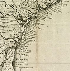
| Description | Detail from a 1733 map showing the coast of North America between present-day Charleston, South Carolina and St. Augustine, Florida. | ||||
| Date | published 1733 | ||||
| Source | The Boston Public Library digital map archive, Call Number: G3290 .P6 1733: http://maps.bpl.org/details_12816/ | ||||
| Author | Henry Popple | ||||
| Permission (Reusing this file) |
|
||||
File history
Click on a date/time to view the file as it appeared at that time.
| Date/Time | Thumbnail | Dimensions | User | Comment | |
|---|---|---|---|---|---|
| current | 20:19, 1 December 2010 | | 964 × 972 (483 KB) | Magicpiano (talk | contribs) | {{Information |Description=Detail from a 1733 map showing the coast of North America between present-day Charleston, South Carolina and St. Augustine, Florida. |Source=The Boston Public Library |
You cannot overwrite this file.
File usage on Commons
There are no pages that use this file.
File usage on other wikis
The following other wikis use this file:
- Usage on en.wikipedia.org
- Usage on es.wikipedia.org
- Usage on it.wikipedia.org
- Usage on nn.wikipedia.org
- Usage on no.wikipedia.org
- Usage on ru.wikipedia.org
- Usage on www.wikidata.org