File:Cargo Schelde Highway, Emder Hafen.jpg
Jump to navigation
Jump to search

Size of this preview: 800 × 414 pixels. Other resolutions: 320 × 166 pixels | 640 × 331 pixels | 1,024 × 530 pixels | 1,280 × 663 pixels | 3,111 × 1,611 pixels.
Original file (3,111 × 1,611 pixels, file size: 2.85 MB, MIME type: image/jpeg)
Captions
Captions
Add a one-line explanation of what this file represents
| Description | |
| Date | |
| Source | Own work |
| Author | kaʁstn Disk/Cat |
| Permission (Reusing this file) |
This file is licensed under the Creative Commons Attribution-Share Alike 3.0 Germany license.
 |
| Camera location | | View this and other nearby images on: OpenStreetMap |
|---|
| Camera Model | Nikon D3000 |
|---|---|
| Shutter speed | 1/320s |
| Aperture | F9.0 |
| Film speed (ISO) | 100 |
| Lens | AF-S DX Zoom-Nikkor 18-55mm f/3.5-5.6G ED II |
| Focal length | 45mm |
This image has been assessed using the Quality image guidelines and is considered a Quality image.
|
File history
Click on a date/time to view the file as it appeared at that time.
| Date/Time | Thumbnail | Dimensions | User | Comment | |
|---|---|---|---|---|---|
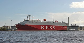
| current | 18:08, 14 February 2011 | | 3,111 × 1,611 (2.85 MB) | Carschten (talk | contribs) | {{subst:User:Carschten/pic | Beschreibung = {{de|Das panamaische Massengut- und Trockenfrachtschiff ''Schelde Highway'' im Emder Hafen}} | Datum = 2010-10-20 | Lizenz = | 360° |
You cannot overwrite this file.
File usage on Commons
The following 3 pages use this file:
File usage on other wikis
The following other wikis use this file:
- Usage on de.wikipedia.org