File:Canada election 2006.png
Original file (2,400 × 1,805 pixels, file size: 2.34 MB, MIME type: image/png)
Captions
Captions
Summary[edit]
| Description |
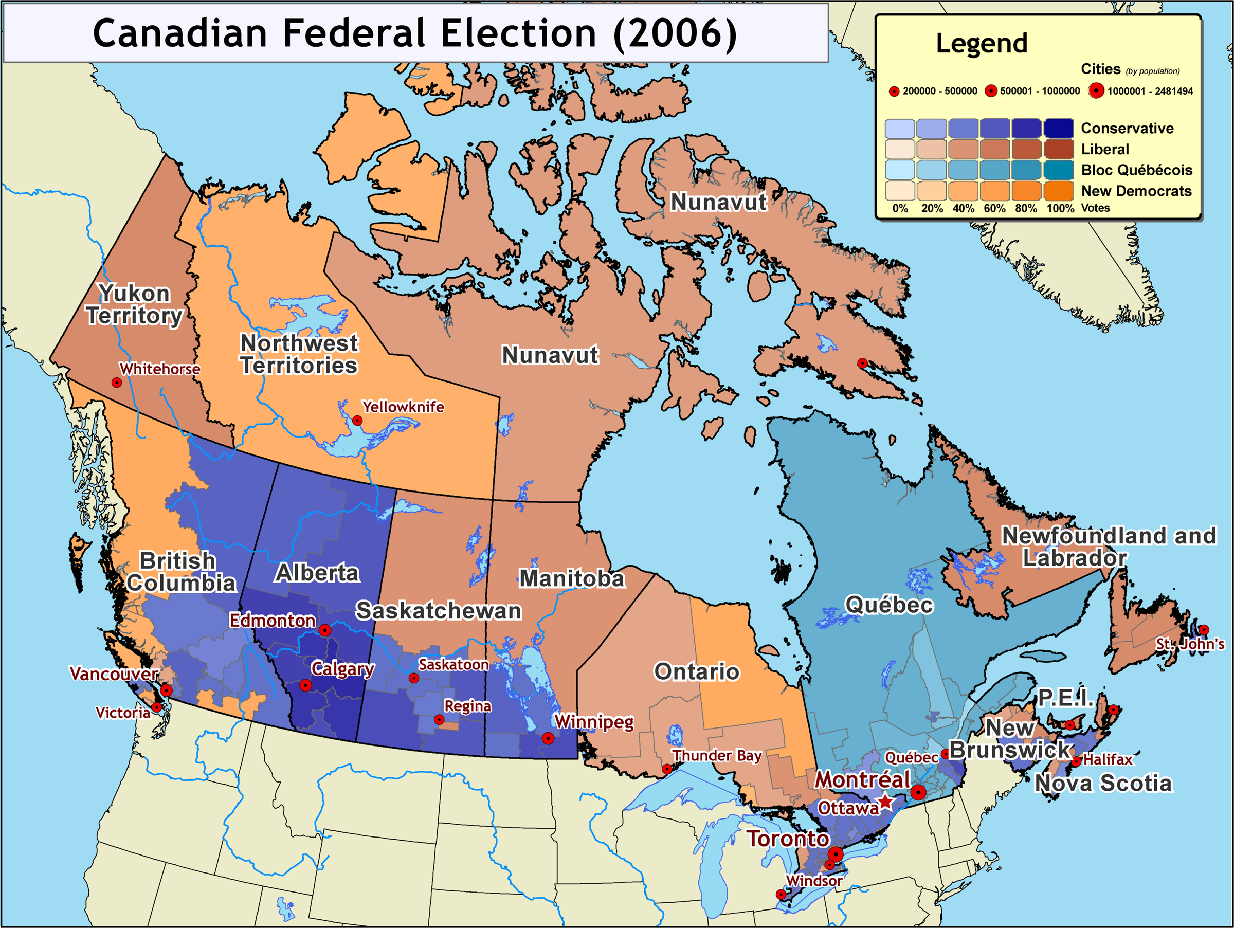
Map of the 2006 Canadian federal election results (January 23, 2006) The Conservative party won a minority government, with Stephen Harper (of Calgary, Alberta) becoming Prime Minister. Alberta is the main stronghold for the Conservative party, with major support also coming from the interior regions of British Columbia, southern Saskatchewan, and Manitoba, as well as southern Ontario. Map created by Kmf164 (January 24, 2006). Map compiled using ArcGIS, Adobe Illustrator, and Adobe Photoshop, and is derived from data sources including:
|
| Date | January 23, 2006 January 24, 2006 |
| Source | Self-published work by Aude |
| Author | Aude |
Licensing[edit]
- You are free:
- to share – to copy, distribute and transmit the work
- to remix – to adapt the work
- Under the following conditions:
- attribution – You must give appropriate credit, provide a link to the license, and indicate if changes were made. You may do so in any reasonable manner, but not in any way that suggests the licensor endorses you or your use.
File history
Click on a date/time to view the file as it appeared at that time.
| Date/Time | Thumbnail | Dimensions | User | Comment | |
|---|---|---|---|---|---|
| current | 22:19, 24 January 2006 | | 2,400 × 1,805 (2.34 MB) | Aude (talk | contribs) | |
| 21:55, 24 January 2006 |  | 2,400 × 1,805 (2.69 MB) | Aude (talk | contribs) | Map of the 2006 Canadian federal election results (January 24, 2006) The Conservative party won a minority government, with Stephen Harper (of Calgary, Alberta) becom |
You cannot overwrite this file.
File usage on Commons
The following page uses this file:
File usage on other wikis
The following other wikis use this file:
- Usage on en.wikipedia.org