File:Canada Nunavut location map-lambert proj.svg
Jump to navigation
Jump to search

Size of this PNG preview of this SVG file: 481 × 599 pixels. Other resolutions: 193 × 240 pixels | 385 × 480 pixels | 616 × 768 pixels | 822 × 1,024 pixels | 1,643 × 2,048 pixels | 512 × 638 pixels.
Original file (SVG file, nominally 512 × 638 pixels, file size: 2.05 MB)
Captions
Captions
Add a one-line explanation of what this file represents
Summary[edit]
| Description |
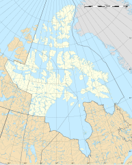
Français : Carte administrative vierge du territoire du Nunavut, Canada, destinée à la géolocalisation.
Lambert conformal conic projection. |
| Date | |
| Source |
Own work
|
| Author | Flappiefh |
| Other versions | Derivative works of this file: Canada Nunavut location map-lambert proj2.svg |
Licensing[edit]
I, the copyright holder of this work, hereby publish it under the following license:
This file is licensed under the Creative Commons Attribution-Share Alike 3.0 Unported license.
- You are free:
- to share – to copy, distribute and transmit the work
- to remix – to adapt the work
- Under the following conditions:
- attribution – You must give appropriate credit, provide a link to the license, and indicate if changes were made. You may do so in any reasonable manner, but not in any way that suggests the licensor endorses you or your use.
- share alike – If you remix, transform, or build upon the material, you must distribute your contributions under the same or compatible license as the original.
File history
Click on a date/time to view the file as it appeared at that time.
| Date/Time | Thumbnail | Dimensions | User | Comment | |
|---|---|---|---|---|---|
| current | 17:34, 6 August 2012 | | 512 × 638 (2.05 MB) | Flappiefh (talk | contribs) |
You cannot overwrite this file.
File usage on Commons
There are no pages that use this file.
File usage on other wikis
The following other wikis use this file:
- Usage on af.wikipedia.org
- Usage on en.wikipedia.org
- Usage on fr.wikipedia.org
- Nunavut
- Iqaluit
- Pangnirtung
- Baie Resolute
- Île de Baffin
- Mont Barbeau
- Île Hans
- Île d'Ellesmere
- Île du Roi-Guillaume
- Alert
- Liste de localités au Nunavut
- Eureka (Nunavut)
- Cambridge Bay
- Pond Inlet
- Arviat
- Îles Belcher
- Île Bathurst (Canada)
- Île Devon
- Île Axel Heiberg
- Rankin Inlet
- Igloulik
- Île du Prince-de-Galles (Canada)
- Grise Fiord
- Île Somerset (Canada)
- Île Bylot
- Parc national Sirmilik
- Île Graham (Nunavut)
- Île Southampton
- Réserve nationale de faune Ninginganiq
- Lac Nettilling
- Île Beechey
- Détroit de Bellot
- Île Flaherty
- Parc national Ukkusiksalik
- Parc national Auyuittuq
- Parc national Quttinirpaaq
- Île Ellef Ringnes
- Détroit de Lancaster
- Île Matty
- Détroit de Fury et Hecla
- Gjoa Haven
- Île Akimiski
- Îles Hovgaard
- Détroit de Victoria
- Nanisivik
View more global usage of this file.