File:Cambodia provinces russian.png
Jump to navigation
Jump to search
Size of this preview: 743 × 600 pixels. Other resolutions: 298 × 240 pixels | 595 × 480 pixels | 1,000 × 807 pixels.
Original file (1,000 × 807 pixels, file size: 94 KB, MIME type: image/png)
Captions
Captions
Add a one-line explanation of what this file represents
Summary[edit]
| Description |
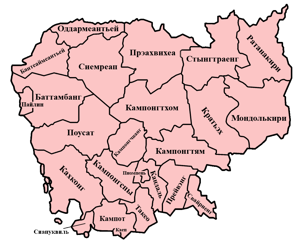
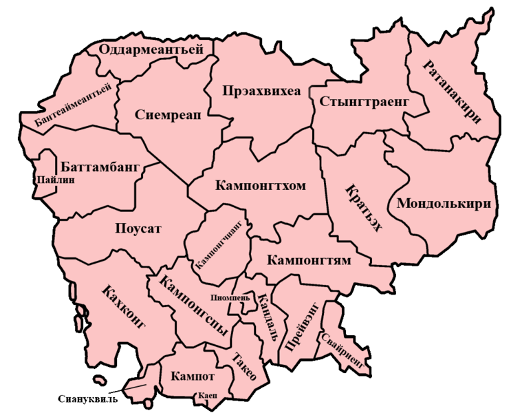
Русский: Административные единицы Камбоджи на карте. |
| Date | |
| Source | based on a map by Morwen on en.wikipedia.org. Category:Maps of Cambodia |
| Author | chliew-chlaat |
Licensing[edit]
| I, the copyright holder of this work, release this work into the public domain. This applies worldwide. In some countries this may not be legally possible; if so: I grant anyone the right to use this work for any purpose, without any conditions, unless such conditions are required by law. |
File history
Click on a date/time to view the file as it appeared at that time.
| Date/Time | Thumbnail | Dimensions | User | Comment | |
|---|---|---|---|---|---|
| current | 11:54, 29 May 2008 | | 1,000 × 807 (94 KB) | Chliew-chlaat (talk | contribs) | {{Information |Description={{ru|1=Административные единицы Камбоджи на карте.}} |Source=based on a map by Morwen on en.wikipedia.org. Category:Maps of Cambodia |Author=chliew-chlaat |Date=29 May 2008 |Permission= |ot |
You cannot overwrite this file.
File usage on Commons
There are no pages that use this file.
File usage on other wikis
The following other wikis use this file:
- Usage on az.wikipedia.org
- Usage on be.wikipedia.org
- Usage on kv.wikipedia.org
- Usage on ru.wikipedia.org
- Usage on uz.wikipedia.org