File:Calle de Hortaleza 106-108 (Madrid) 01.jpg
Jump to navigation
Jump to search

Size of this preview: 440 × 600 pixels. Other resolutions: 176 × 240 pixels | 352 × 480 pixels | 563 × 768 pixels | 751 × 1,024 pixels | 1,502 × 2,048 pixels | 3,169 × 4,320 pixels.
Original file (3,169 × 4,320 pixels, file size: 1.54 MB, MIME type: image/jpeg)
Captions
Captions
Add a one-line explanation of what this file represents
| Description |
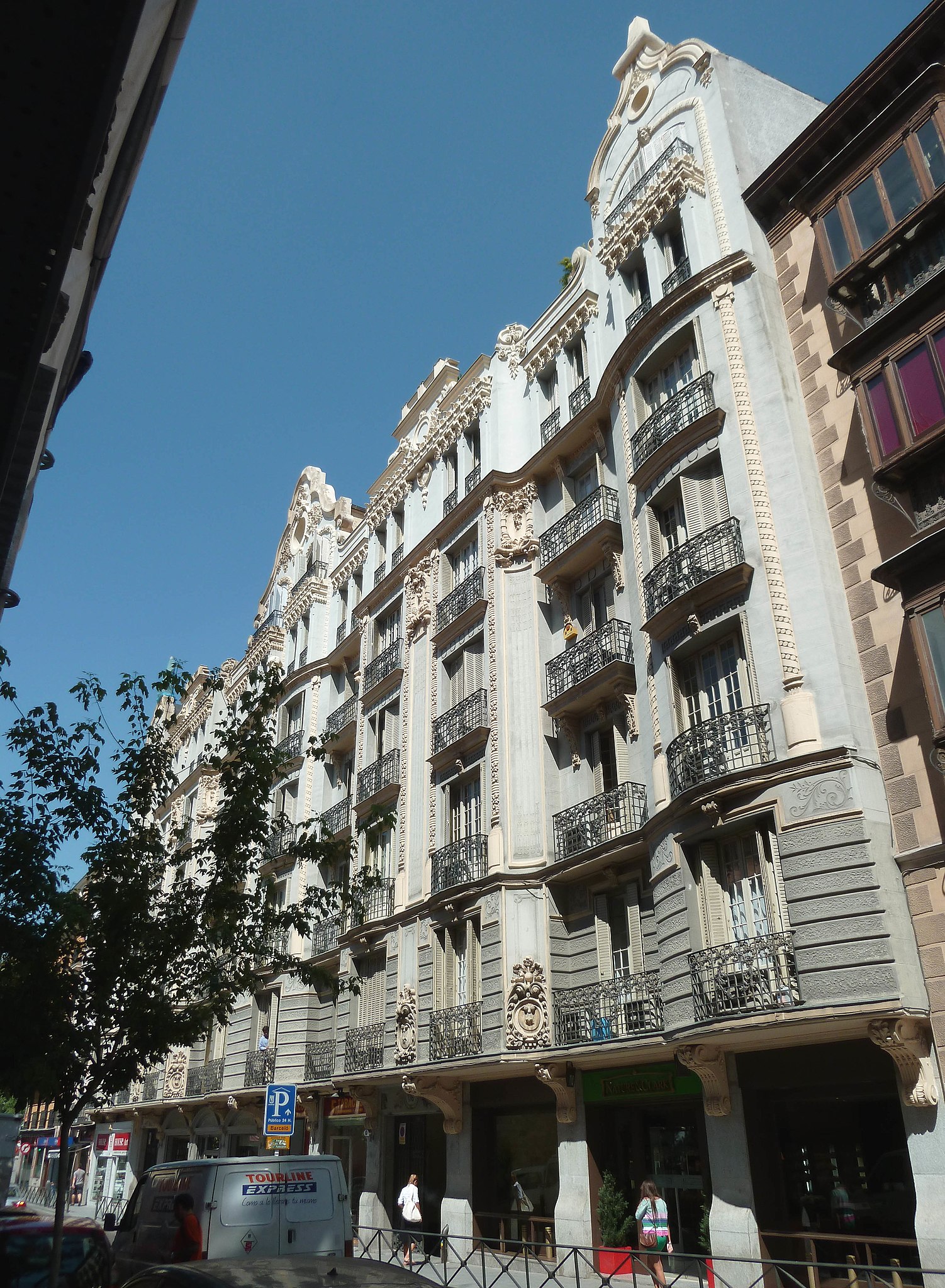
English: Façade of the building at 106–108 Calle de Hortaleza (street) in Madrid (Spain). It was projected in 1912 by architect Joaquín Saldaña López and built from 1912 to 1915 as two housings for the marquis of Falces and Sofía Murga.
Español: Fachada del edificio del nº 106–108 de la Calle de Hortaleza de Madrid (España). Fue proyectado en 1912 por el arquitecto Joaquín Saldaña López y construido de 1912 a 1915 como dos edificios de viviendas para el marqués de Falces y Dª Sofía Murga. |
||
| Date | |||
| Source | Own work | ||
| Author | Luis García (Zaqarbal) | ||
| Permission (Reusing this file) |
I, the copyright holder of this work, hereby publish it under the following licenses:
This file is licensed under the Creative Commons Attribution-Share Alike 3.0 Unported license. Attribution: Luis García
You may select the license of your choice. |

| Object location | | View this and other nearby images on: OpenStreetMap |
|---|
_01.jpg¶ms=040.425528_N_-003.697386_E_globe:Earth_class:object_type:landmark_region:ES_&language=en)
File history
Click on a date/time to view the file as it appeared at that time.
| Date/Time | Thumbnail | Dimensions | User | Comment | |
|---|---|---|---|---|---|
| current | 02:37, 1 August 2012 | | 3,169 × 4,320 (1.54 MB) | Zaqarbal (talk | contribs) | Photo taken by Luis García (Zaqarbal) on June 24, 2011. Hereby published under GFDL and Cc-by-sa-3.0 licenses. |
You cannot overwrite this file.
File usage on Commons
The following page uses this file:
File usage on other wikis
The following other wikis use this file:
- Usage on es.wikipedia.org
_01.jpg&oldid=846092865)