File:Californian Channel Islands map de.png
Jump to navigation
Jump to search
Size of this preview: 706 × 600 pixels. Other resolutions: 283 × 240 pixels | 565 × 480 pixels | 905 × 768 pixels | 1,200 × 1,019 pixels.
Original file (1,200 × 1,019 pixels, file size: 240 KB, MIME type: image/png)
Captions
Captions
Add a one-line explanation of what this file represents
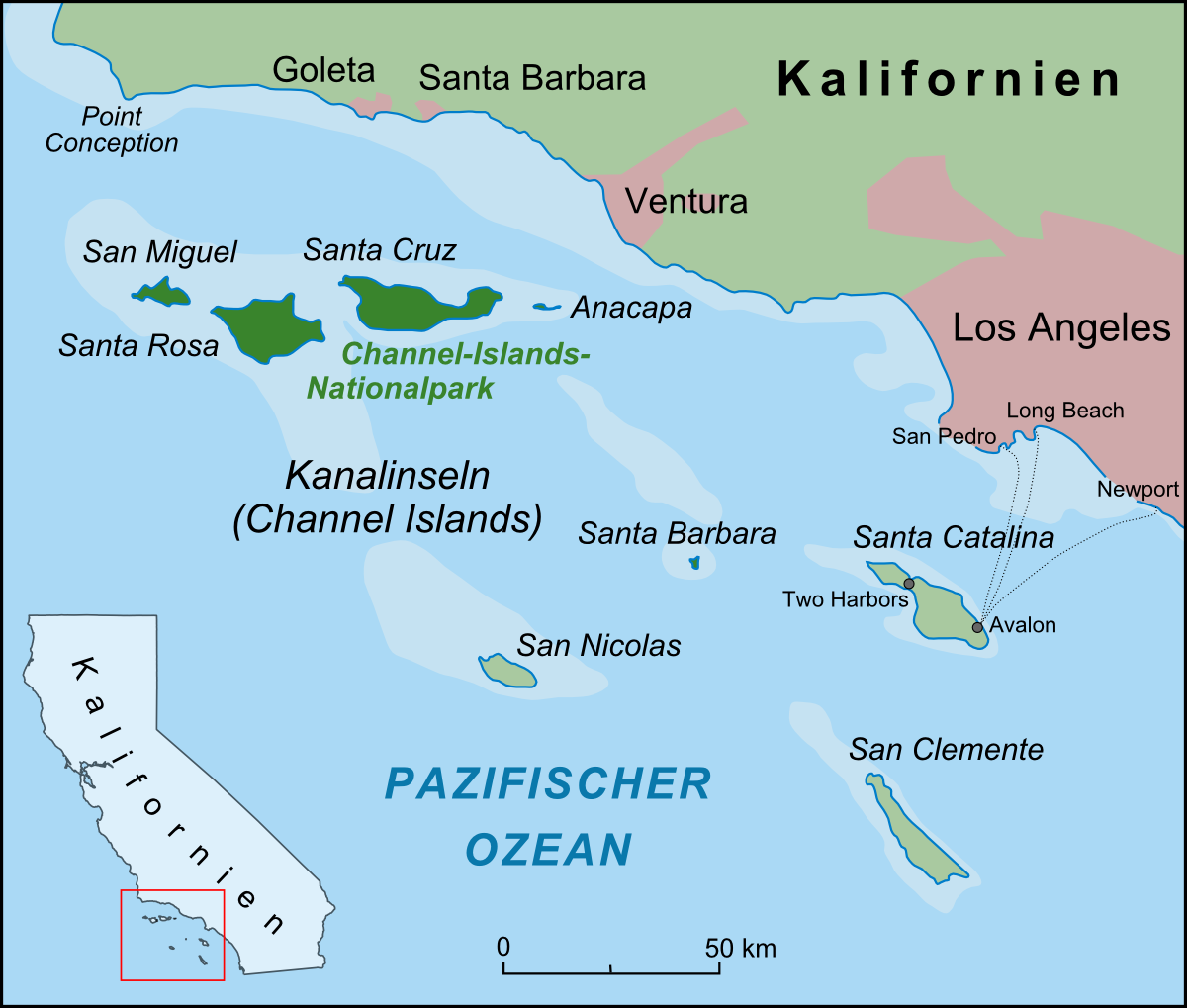
| Description | Karte der Kanalinseln vor der Küste Kaliforniens |
| Date | |
| Source |
own work, used:
|
| Author | Lencer |
| Other versions |
 |

|
This map has been made or improved in the German Kartenwerkstatt (Map Lab). You can propose maps to improve as well.
|
This file is licensed under the Creative Commons Attribution-Share Alike 3.0 Unported license.
- You are free:
- to share – to copy, distribute and transmit the work
- to remix – to adapt the work
- Under the following conditions:
- attribution – You must give appropriate credit, provide a link to the license, and indicate if changes were made. You may do so in any reasonable manner, but not in any way that suggests the licensor endorses you or your use.
- share alike – If you remix, transform, or build upon the material, you must distribute your contributions under the same or compatible license as the original.
File history
Click on a date/time to view the file as it appeared at that time.
| Date/Time | Thumbnail | Dimensions | User | Comment | |
|---|---|---|---|---|---|
| current | 05:30, 14 April 2009 | | 1,200 × 1,019 (240 KB) | Lencer (talk | contribs) | + Fährverbindungen |
| 11:19, 8 April 2009 |  | 1,200 × 1,093 (238 KB) | Lencer (talk | contribs) | {{Information| |Description=Karte der Kanalinseln vor der Küste Kaliforniens |Source=own work, used: * Google Earth * nach Californian Channelislands.jpg der National Oceanic and Atmospheric Administration |Da |
You cannot overwrite this file.
File usage on Commons
There are no pages that use this file.
File usage on other wikis
The following other wikis use this file:
- Usage on az.wikipedia.org
- Usage on ceb.wikipedia.org
- Usage on de.wikipedia.org
- Kalifornien
- Channel-Islands-Nationalpark
- Insel-Graufuchs
- Kanalinseln (Kalifornien)
- Santa Catalina Island
- Santa Cruz Island
- Anacapa Island
- San Miguel Island (Kalifornien)
- Benutzer:Lencer
- San Clemente Island
- Wikipedia:Löschkandidaten/15. April 2009
- Santa Barbara Island
- Santa Rosa Island (Kalifornien)
- Wikipedia:Kartenwerkstatt/Archiv/2009-04
- Usage on eo.wikipedia.org
- Usage on ru.wikipedia.org
- Usage on uk.wikipedia.org