File:California map showing Tulare County.png
Jump to navigation
Jump to search
No higher resolution available.
California_map_showing_Tulare_County.png (200 × 231 pixels, file size: 22 KB, MIME type: image/png)
Captions
Captions
Add a one-line explanation of what this file represents
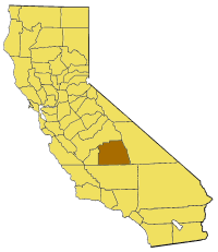
Map of Tulare county in California. From en:

|
Permission is granted to copy, distribute and/or modify this document under the terms of the GNU Free Documentation License, Version 1.2 or any later version published by the Free Software Foundation; with no Invariant Sections, no Front-Cover Texts, and no Back-Cover Texts. A copy of the license is included in the section entitled GNU Free Documentation License. |
| This file is licensed under the Creative Commons Attribution-Share Alike 3.0 Unported license. | ||
| ||
| This licensing tag was added to this file as part of the GFDL licensing update. |
File history
Click on a date/time to view the file as it appeared at that time.
| Date/Time | Thumbnail | Dimensions | User | Comment | |
|---|---|---|---|---|---|
| current | 15:32, 14 July 2005 | | 200 × 231 (22 KB) | Pyramide~commonswiki (talk | contribs) | Map of Tulare county in California. From en: {{GFDL}} Category:Maps of counties in California |
You cannot overwrite this file.
File usage on Commons
There are no pages that use this file.
File usage on other wikis
The following other wikis use this file:
- Usage on en.wikipedia.org
- Badger, California
- Kaweah Peaks Ridge
- Black Kaweah
- Red Kaweah
- Kaweah Queen
- Template:TulareCountyCA-geo-stub
- Crystal Cave (Sequoia National Park)
- Mount Barnard (California)
- Lilliput Glacier
- Eagle Lake (Tulare County)
- Cabin Cove, California
- Sawtooth Peak
- Table Mountain (Tulare County, California)
- Kaweah Gap
- The Needles (Sequoia National Forest)
- Forester Pass
- Mount Le Conte (California)
- Florence Peak (California)
- Sirretta Peak
- Freeman Creek Grove
- Triple Divide Peak (Tulare County, California)
- Garfield Grove
- Atwell Mill Grove
- Belknap Complex
- Stagg (tree)
- Genesis (tree)
- Adam (tree)
- Venice Hills
- Mount Brewer
- Mount Clarence King
- Mount Mallory
- Beverly Glen, Visalia, California
- Lime Kiln Creek
- Blue Ridge National Wildlife Refuge
- Green Acres, Visalia, California
- Kaweah, California
- Calgro, California
- Mill Creek (Tulare County)
- Rocky Hill, Tulare County, California
- Transportation in Visalia
- Yokohl Valley, California
- Cameron Creek
- Packwood Creek
- Alta Peak
- Thunder Mountain (Tulare County, California)
- Mount Stewart (California)
- Advance, California
- Balance Rock, California
- Angiola, California
- Zante, California
View more global usage of this file.