File:California map showing Kern County.png
Jump to navigation
Jump to search
No higher resolution available.
California_map_showing_Kern_County.png (200 × 231 pixels, file size: 22 KB, MIME type: image/png)
Captions
Captions
Add a one-line explanation of what this file represents
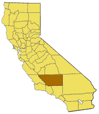
Map of Kern county in California. From en:

|
Permission is granted to copy, distribute and/or modify this document under the terms of the GNU Free Documentation License, Version 1.2 or any later version published by the Free Software Foundation; with no Invariant Sections, no Front-Cover Texts, and no Back-Cover Texts. A copy of the license is included in the section entitled GNU Free Documentation License. |
| This file is licensed under the Creative Commons Attribution-Share Alike 3.0 Unported license. | ||
| ||
| This licensing tag was added to this file as part of the GFDL licensing update. |
File history
Click on a date/time to view the file as it appeared at that time.
| Date/Time | Thumbnail | Dimensions | User | Comment | |
|---|---|---|---|---|---|
| current | 17:03, 1 July 2005 | | 200 × 231 (22 KB) | Pyramide~commonswiki (talk | contribs) | Map of Kern county in California. From en: {{GFDL}} Category:Maps of counties in California |
You cannot overwrite this file.
File usage on Commons
There are no pages that use this file.
File usage on other wikis
The following other wikis use this file:
- Usage on bg.wikipedia.org
- Usage on en.wikipedia.org
- Brown Peak (Kern County, California)
- Wonder Acres, Kern County, California
- Cache Creek (Kern County, California)
- Lost Hills
- Bear Mountain (Kern County, California)
- Edwards, California
- Keyesville, California
- Cantil, California
- Honda Proving Center of California
- Locarno Mine
- El Paso Mountains Wilderness
- Garlock, California
- Indian Wells (Kern County, California)
- Rand Mountains
- Fremont Valley
- Desert Tortoise Natural Area
- El Paso Mountains
- Scodie Mountains
- Greenhorn Mountains
- Jawbone–Butterbredt Area of Critical Environmental Concern
- Willow Springs, Kern County, California
- Famoso, California
- Walker Basin
- Template:KernCountyCA-geo-stub
- White Wolf Fault
- San Emigdio Mountain
- Sawmill Mountain
- Cerro Noroeste
- Grouse Mountain (California)
- Brush Mountain (Kern County, California)
- Cummings Mountain (California)
- Independence dike swarm
- Bealville, California
- Antimony Peak
- Eagle Rest Peak
- Tecuya Mountain
- South Lake, Kern County, California
- Edison, California
- Antelope Hills, California
- Bacon Hills
- Bissell Hills
- Black Hills (Kern County)
- Buena Vista Hills (Kern County)
- Elk Hills
- Horned Toad Hills
- Little Signal Hills
- Pleito Hills
- Rosamond Hills
- Shale Hills
View more global usage of this file.