File:California county map (San Francisco County enlarged).svg
Jump to navigation
Jump to search

Size of this PNG preview of this SVG file: 508 × 600 pixels. Other resolutions: 203 × 240 pixels | 407 × 480 pixels | 651 × 768 pixels | 867 × 1,024 pixels | 1,735 × 2,048 pixels | 621 × 733 pixels.
Original file (SVG file, nominally 621 × 733 pixels, file size: 506 KB)
Captions
Captions
Add a one-line explanation of what this file represents
Summary[edit]
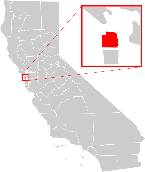
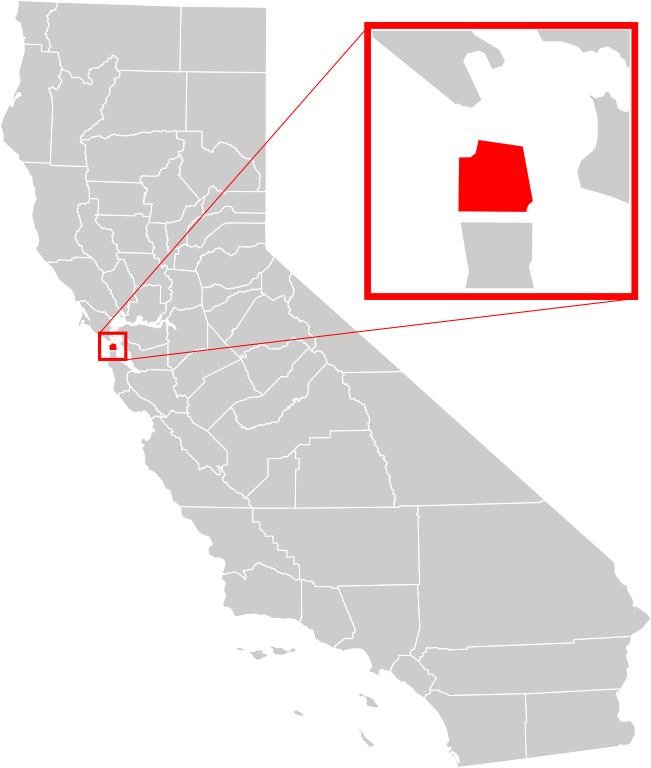
| Description | A county locator map of California, with San Francisco County highlighted and enlarged in red. |
| Date | |
| Source | Own work based on: California county map (San Francisco County highlighted).svg and California Map showing San Francisco County.png |
| Author | Optigan13 based on works of Thadius856 and Kurykh |
| Other versions |
|
| SVG development | and with Inkscape. This Adobe SVG locator map is very large because Optigan13 kept the superfluous Adobe PGF or other CDATA garbage . |
.svg)

.svg&action=edit§ion=1)
Licensing[edit]
.svg&action=edit§ion=2)
| I, the copyright holder of this work, release this work into the public domain. This applies worldwide. In some countries this may not be legally possible; if so: I grant anyone the right to use this work for any purpose, without any conditions, unless such conditions are required by law. |
File history
Click on a date/time to view the file as it appeared at that time.
| Date/Time | Thumbnail | Dimensions | User | Comment | |
|---|---|---|---|---|---|
| current | 07:10, 19 June 2008 | | 621 × 733 (506 KB) | Optigan13 (talk | contribs) | {{Information |Description=A county locator map of California, with San Francisco County highlighted and enlarged in red. |Source=Image:California county map (San Francisco County highlighted).svg and [[:Image:California Map showing San Francisco Cou |
You cannot overwrite this file.
File usage on Commons
More than 100 pages use this file. The following list shows the first 100 pages that use this file only. A full list is available.
.svg)
- San Francisco
- File:California Map showing San Francisco County.png
- File:California map showing San Francisco County.png
- Category:1868 in San Francisco
- Category:1906 in San Francisco
- Category:1913 in San Francisco
- Category:1959 in San Francisco
- Category:1960 in San Francisco
- Category:1961 in San Francisco
- Category:1962 in San Francisco
- Category:1963 in San Francisco
- Category:1964 in San Francisco
- Category:1965 in San Francisco
- Category:1966 in San Francisco
- Category:1967 in San Francisco
- Category:1968 in San Francisco
- Category:1969 in San Francisco
- Category:1970 in San Francisco
- Category:1971 in San Francisco
- Category:1972 in San Francisco
- Category:1973 in San Francisco
- Category:1974 in San Francisco
- Category:1975 in San Francisco
- Category:1976 in San Francisco
- Category:1977 in San Francisco
- Category:1978 in San Francisco
- Category:1979 in San Francisco
- Category:1980 in San Francisco
- Category:1981 in San Francisco
- Category:1982 in San Francisco
- Category:1983 in San Francisco
- Category:1984 in San Francisco
- Category:1985 in San Francisco
- Category:1986 in San Francisco
- Category:1987 in San Francisco
- Category:1988 in San Francisco
- Category:1989 in San Francisco
- Category:1990 in San Francisco
- Category:1991 in San Francisco
- Category:1992 in San Francisco
- Category:1993 in San Francisco
- Category:1994 in San Francisco
- Category:1995 in San Francisco
- Category:1996 in San Francisco
- Category:1997 in San Francisco
- Category:1998 in San Francisco
- Category:1999 in San Francisco
- Category:2000 in San Francisco
- Category:2001 in San Francisco
- Category:2002 in San Francisco
- Category:2003 in San Francisco
- Category:2004 in San Francisco
- Category:2005 in San Francisco
- Category:2006 in San Francisco
- Category:2007 in San Francisco
- Category:2008 in San Francisco
- Category:2009 in San Francisco
- Category:2010 in San Francisco
- Category:2011 in San Francisco
- Category:2012 in San Francisco
- Category:2013 in San Francisco
- Category:2014 in San Francisco
- Category:2015 in San Francisco
- Category:2016 in San Francisco
- Category:2017 in San Francisco
- Category:2018 in San Francisco
- Category:2019 in San Francisco
- Category:2020 in San Francisco
- Category:2021 in San Francisco
- Category:Births in San Francisco
- Category:Bridges in San Francisco
- Category:Companies based in San Francisco
- Category:Deaths in San Francisco
- Category:Events in San Francisco, California
- Category:Film directors from San Francisco
- Category:Film sets in San Francisco
- Category:Geography of San Francisco
- Category:Hills of San Francisco, California
- Category:Hospitals in San Francisco
- Category:Lighthouses in San Francisco
- Category:Maps of San Francisco
- Category:National Historic Landmarks in San Francisco, California
- Category:Parks in San Francisco
- Category:Roads in San Francisco
- Category:San Francisco
- Category:San Francisco in the 1900s
- Category:San Francisco in the 1910s
- Category:San Francisco in the 1920s
- Category:San Francisco in the 1930s
- Category:San Francisco in the 1940s
- Category:San Francisco in the 1950s
- Category:San Francisco in the 1960s
- Category:San Francisco in the 1980s
- Category:San Francisco in the 1990s
- Category:San Francisco in the 2000s
- Category:San Francisco in the 2010s
- Category:San Francisco in the 2020s
- Category:Streetcar 228 (San Francisco)
- Category:Streetcar 233 (San Francisco)
- Category:Streets in San Francisco
View more links to this file.
File usage on other wikis
The following other wikis use this file:
- Usage on af.wikipedia.org
- Usage on ang.wikipedia.org
- Usage on ar.wikipedia.org
- Usage on arz.wikipedia.org
- Usage on ast.wikipedia.org
- Usage on bg.wikipedia.org
- Usage on bn.wikipedia.org
- Usage on ca.wikipedia.org
- Usage on ceb.wikipedia.org
- Usage on chy.wikipedia.org
- Usage on diq.wikipedia.org
- Usage on el.wikipedia.org
- Usage on en.wikipedia.org
- San Francisco
- Presidio of San Francisco
- North Beach, San Francisco
- Yerba Buena Island
- Treasure Island, San Francisco
- Richmond District, San Francisco
- Sunset District, San Francisco
- Noe Valley, San Francisco
- Haight-Ashbury
- Golden Gate Park
- Bayview–Hunters Point, San Francisco
- Chinatown, San Francisco
- South of Market, San Francisco
- Civic Center, San Francisco
- Mission District, San Francisco
- Japantown, San Francisco
- San Francisco City Hall
- Ocean Beach, San Francisco
- Bernal Heights, San Francisco
- Anza Vista, San Francisco
- Duboce Triangle, San Francisco
- San Francisco Cable Car Museum
- Russian Hill, San Francisco
- Moscone Recreation Center
- Union Square, San Francisco
- West Portal, San Francisco
- List of neighborhoods in San Francisco
- Embarcadero (San Francisco)
- Alamo Square, San Francisco
- Fisherman's Wharf, San Francisco
- Hayes Valley, San Francisco
- Western Addition, San Francisco
- Glen Park, San Francisco
- Financial District, San Francisco
- St. Francis Wood, San Francisco
- Cole Valley, San Francisco
View more global usage of this file.
.svg)
.svg&oldid=845972455)