File:Caicos Islands satellite.jpg
Jump to navigation
Jump to search

Size of this preview: 767 × 599 pixels. Other resolutions: 307 × 240 pixels | 615 × 480 pixels | 983 × 768 pixels | 1,280 × 1,000 pixels | 2,597 × 2,029 pixels.
Original file (2,597 × 2,029 pixels, file size: 463 KB, MIME type: image/jpeg)
Captions
Captions
Add a one-line explanation of what this file represents
Summary[edit]
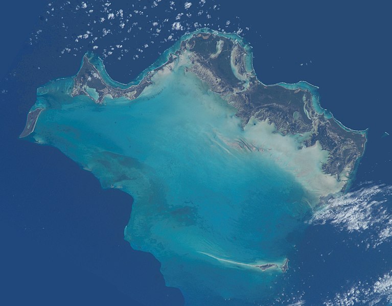
| Description | The Caicos Islands, from and image from the International Space Station |
| Date | |
| Source | NASA Earth Observatory, adjusted by User:Hogweard |
| Author | NASA image courtesy of the NASA/GSFC/METI/ERSDAC/JAROS and U.S./Japan ASTER Science Team |
| Camera location | | View this and other nearby images on: OpenStreetMap |
|---|
Licensing[edit]
| This file is in the public domain in the United States because it was solely created by NASA. NASA copyright policy states that "NASA material is not protected by copyright unless noted". (See Template:PD-USGov, NASA copyright policy page or JPL Image Use Policy.) | ||
 |
Warnings:
|
File history
Click on a date/time to view the file as it appeared at that time.
| Date/Time | Thumbnail | Dimensions | User | Comment | |
|---|---|---|---|---|---|
| current | 23:33, 29 January 2013 | | 2,597 × 2,029 (463 KB) | Hogweard (talk | contribs) | {{Information |Description=The Caicos Islands, from and image from the International Space Station |Source=[http://eol.jsc.nasa.gov/scripts/sseop/QuickView.pl?directory=ESC&ID=ISS006-E-47804 NASA Earth Observatory], adjusted by User:Hogweard |Date=... |
You cannot overwrite this file.
File usage on Commons
There are no pages that use this file.
File usage on other wikis
The following other wikis use this file:
- Usage on pl.wikipedia.org