File:CZ-cleneni-Slezsko-wl.svg
Jump to navigation
Jump to search

Size of this PNG preview of this SVG file: 800 × 460 pixels. Other resolutions: 320 × 184 pixels | 640 × 368 pixels | 1,024 × 589 pixels | 1,280 × 736 pixels | 2,560 × 1,471 pixels | 3,433 × 1,973 pixels.
Original file (SVG file, nominally 3,433 × 1,973 pixels, file size: 127 KB)
Captions
Captions
Add a one-line explanation of what this file represents
Summary[edit]
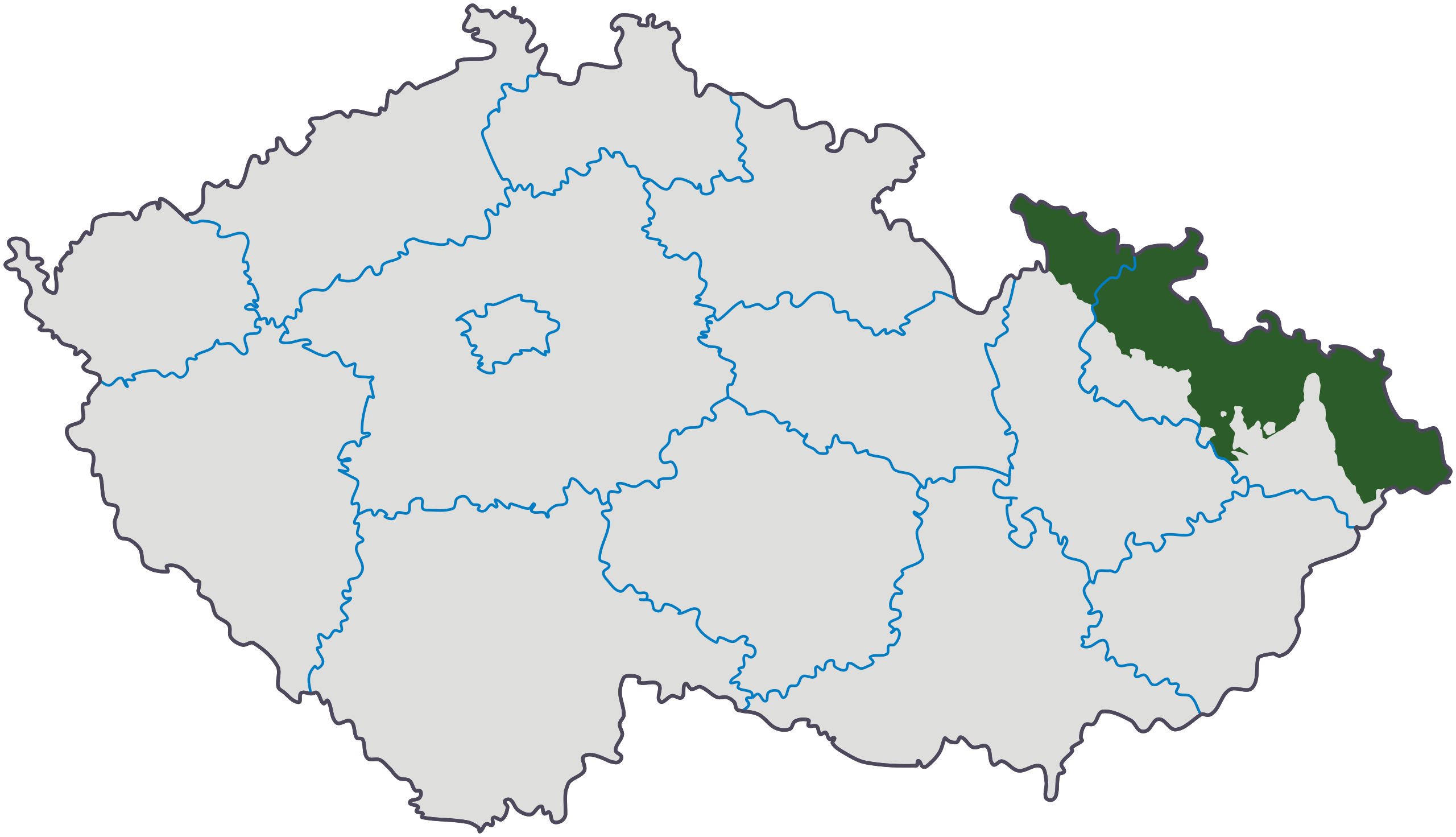
| Description |
Čeština: Vektorová mapa Česka s dělením na kraje a vyznačením Slezska (ale bez Moravských enkláv, takže ta mapa je něpřesná).
English: A vector map of the Czech regions with Silesia emphasized (but without the Moravian enclaves so the map is inaccurate).
Esperanto: Vektora mapo de Ĉeĥujo kun regiona dividigo kaj markita Silezio (sed sen Moraviaj enklavoj, do temas pri nepreciza mapo). |
||||||||||
| Date | |||||||||||
| Source | |||||||||||
| Author | Derivative work: Petr Adam Dohnálek | ||||||||||
| Permission (Reusing this file) |
|

Original upload log[edit]
This image is a derivative work of the following images:
- File:CZ-cleneni-Slezsko-wl.png licensed with GFDL, GFDL/en
- 2006-10-29T13:57:25Z Kirk 3662x2104 (564770 Bytes)
- 2006-05-22T16:46:53Z Kirk 800x460 (95297 Bytes)
- 2006-05-21T17:33:09Z Kirk 800x460 (95495 Bytes)
- 2006-05-21T16:39:58Z Kirk 800x460 (95498 Bytes)
- 2006-05-21T14:26:03Z Kirk 800x460 (95492 Bytes)
- 2005-03-21T11:32:17Z Wiki-vr 197x114 (2701 Bytes) [[Czech Silesia]] (see also [[Silesia]]) on the map of present [[Czechia]]
- File:Cesko-kraje.svg licensed with GFDL, GFDL/en, PD-user
- 2009-02-03T11:38:43Z Petrus Adamus 3433x1973 (75493 Bytes) optimalizace SVG • plibonigo de SVG • SVG optimalization
- 2006-07-02T02:59:15Z Hexagon1 3433x1973 (173683 Bytes) en: Czech regions cs: České kraje
Uploaded with derivativeFX
File history
Click on a date/time to view the file as it appeared at that time.
| Date/Time | Thumbnail | Dimensions | User | Comment | |
|---|---|---|---|---|---|
| current | 22:25, 4 February 2009 | | 3,433 × 1,973 (127 KB) | Petrus Adamus (talk | contribs) | Vylepšení obvodu • perimeter repair |
| 19:23, 3 February 2009 |  | 3,433 × 1,973 (105 KB) | Petrus Adamus (talk | contribs) | {{Information |Description=Czech Silesia ''(in green)'' on the map of present Czechia. See also Silesia ''Crated by editing map http://cs.wikipedia.org/wiki/Soubor:%C4%8Cesko-kraje.svg'' See also: http://cs.wikipedia.org/wiki/Soubor:%C4%8Ces |
You cannot overwrite this file.
File usage on Commons
There are no pages that use this file.
File usage on other wikis
The following other wikis use this file:
- Usage on diq.wikipedia.org
- Usage on eo.wikipedia.org