File:CSIRO ScienceImage 1441 Aerial view of Lake Frome.jpg
Jump to navigation
Jump to search
Size of this preview: 800 × 532 pixels. Other resolutions: 320 × 213 pixels | 640 × 425 pixels | 945 × 628 pixels.
Original file (945 × 628 pixels, file size: 750 KB, MIME type: image/jpeg)
Captions
Captions
Add a one-line explanation of what this file represents
Summary[edit]
| Description |
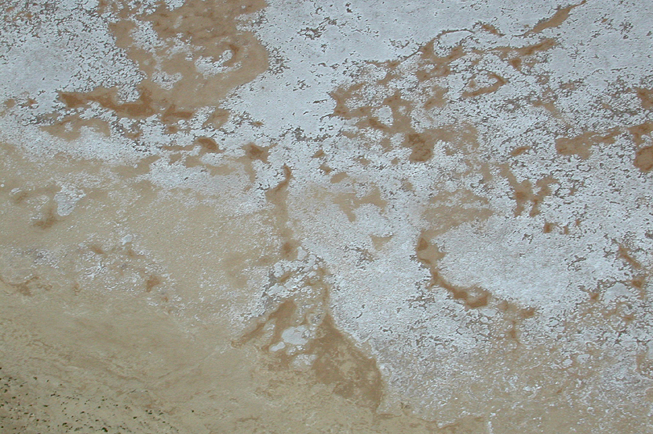
English: Aerial view of Lake Frome. Lake Frome is a salt lake 500 kms north of Adelaide, South Australia. Scientists from CSIRO's Earth Observation Centre spent a week on the lake in December 2000 helping to test a new NASA satellite EO-1. Launched in November 2000, EO-1contains the "Hyperion" imaging equipment which measures much more detailed information about the earth's surface than previous satellite instruments. |
| Date | |
| Source | http://www.scienceimage.csiro.au/image/1441 |
| Author | CSIRO Atmospheric Research, CSIRO |
| Permission (Reusing this file) |
http://www.scienceimage.csiro.au/pages/about/ |
| Rights holder | CSIRO |
Licensing[edit]
This file is licensed under the Creative Commons Attribution 3.0 Unported license.
Attribution: CSIRO
- You are free:
- to share – to copy, distribute and transmit the work
- to remix – to adapt the work
- Under the following conditions:
- attribution – You must give appropriate credit, provide a link to the license, and indicate if changes were made. You may do so in any reasonable manner, but not in any way that suggests the licensor endorses you or your use.
File history
Click on a date/time to view the file as it appeared at that time.
| Date/Time | Thumbnail | Dimensions | User | Comment | |
|---|---|---|---|---|---|
| current | 20:55, 17 September 2014 | | 945 × 628 (750 KB) | File Upload Bot (99of9) (talk | contribs) | {{User:99of9/CSIRO_template |id=1441 |Title=Aerial view of Lake Frome |Creator=CSIRO Atmospheric Research |Creator_scheme=LCNA |Date=2003-09-19 |Date_scheme=ISO8601 |Description=Aerial view of Lake Frome.<p>Lake Frome is a salt lake 500 kms north of Ad... |
You cannot overwrite this file.
File usage on Commons
There are no pages that use this file.