File:CIS membership map.png
Jump to navigation
Jump to search
Size of this preview: 800 × 547 pixels. Other resolutions: 320 × 219 pixels | 640 × 438 pixels | 1,024 × 701 pixels | 1,356 × 928 pixels.
Original file (1,356 × 928 pixels, file size: 47 KB, MIME type: image/png)
Captions
Captions
Add a one-line explanation of what this file represents
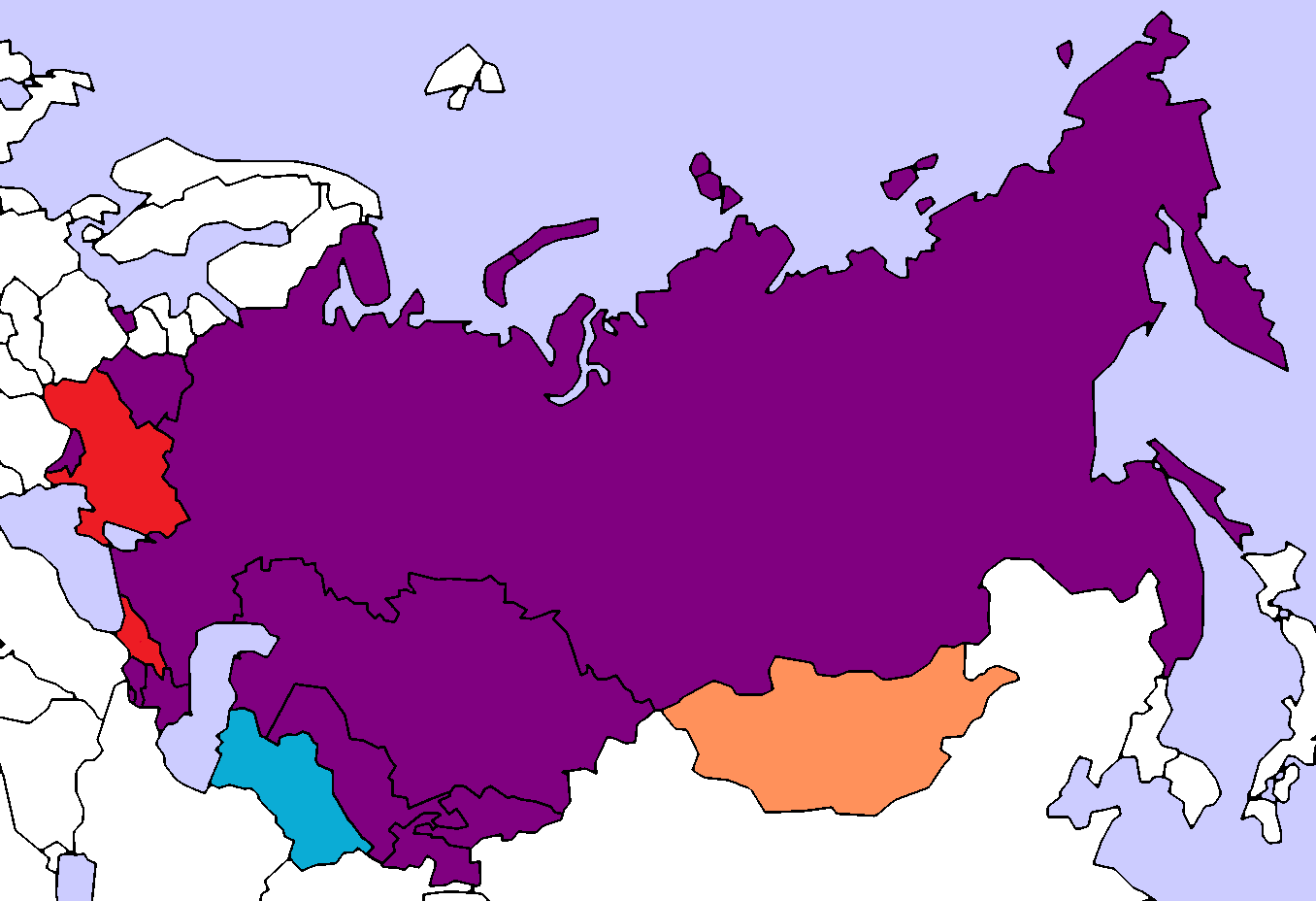
Map of the Commonwealth of Independent States (CIS).

|
Permission is granted to copy, distribute and/or modify this document under the terms of the GNU Free Documentation License, Version 1.2 or any later version published by the Free Software Foundation; with no Invariant Sections, no Front-Cover Texts, and no Back-Cover Texts. A copy of the license is included in the section entitled GNU Free Documentation License. |
| This file is licensed under the Creative Commons Attribution-Share Alike 3.0 Unported license. | ||
| ||
| This licensing tag was added to this file as part of the GFDL licensing update. |
| Description |
English: A map of CIS members
Member country
Associate member country
Non-member but participates in some meetings
Former member country |
||
| Date | |||
| Source |
|
||
| Author | Vidokov | ||
| Permission (Reusing this file) |
|
||
| Other versions | Derivative works of this file: Gos metnummers.jpg |
File history
Click on a date/time to view the file as it appeared at that time.
| Date/Time | Thumbnail | Dimensions | User | Comment | |
|---|---|---|---|---|---|
| current | 00:19, 9 September 2018 | | 1,356 × 928 (47 KB) | Andrew J.Kurbiko (talk | contribs) | Ukraine is out |
| 17:23, 22 January 2018 |  | 1,356 × 928 (47 KB) | Maphobbyist (talk | contribs) | Change of color for Georgia, so that it is the same as in the legend. | |
| 00:50, 4 January 2016 |  | 1,356 × 928 (73 KB) | Danlaycock (talk | contribs) | rvt - no evidence ukraine has actually withdrawn | |
| 21:16, 19 March 2014 |  | 1,356 × 928 (62 KB) | A2D2 (talk | contribs) | Update | |
| 15:01, 17 January 2011 |  | 1,356 × 928 (62 KB) | Maphobbyist (talk | contribs) | Removed Georgia | |
| 23:20, 15 October 2008 |  | 1,356 × 928 (73 KB) | Vidokov (talk | contribs) | Reverted to version as of 20:48, 2 October 2008 | |
| 23:20, 15 October 2008 |  | 1,356 × 928 (73 KB) | Vidokov (talk | contribs) | Reverted to version as of 00:15, 5 October 2008 | |
| 23:19, 15 October 2008 |  | 1,356 × 928 (73 KB) | Vidokov (talk | contribs) | Reverted to version as of 20:48, 2 October 2008 | |
| 00:15, 5 October 2008 |  | 1,356 × 928 (73 KB) | DDima (talk | contribs) | this is incorrect. Ukraine is not a member of the CIS. | |
| 20:48, 2 October 2008 |  | 1,356 × 928 (73 KB) | Vidokov (talk | contribs) | Map of the Commonwealth of Independent States (CIS). {{GFDL}} {{Information |Description={{en|A map of the location of Russia and Uzbekistan}} {{legend|#AA3580|Member country}} {{legend|#009FC2|Associate member country}} {{legend|#DD3C26|Countries announ |
You cannot overwrite this file.
File usage on Commons
There are no pages that use this file.